


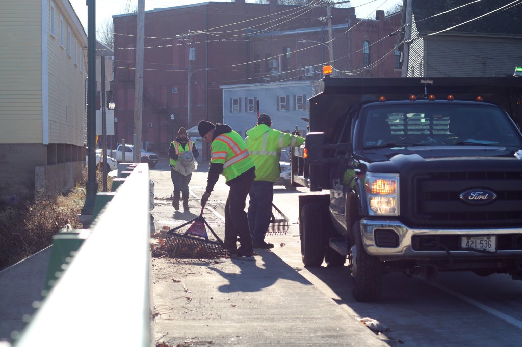


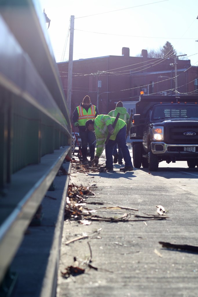
Gardiner public works crews were cleaning up debris Thursday morning that was stuck on the Maine Avenue bridge, including food items that had apparently been washed out of the closed Hannaford store across the street that was inundated with Kennebec River floodwaters.
Nearby, Greg Stewart and his son, Alex, rushed to document just how bad things got when the water had reached its crest, as part of efforts to prepare for any more catastrophic floods in the future.
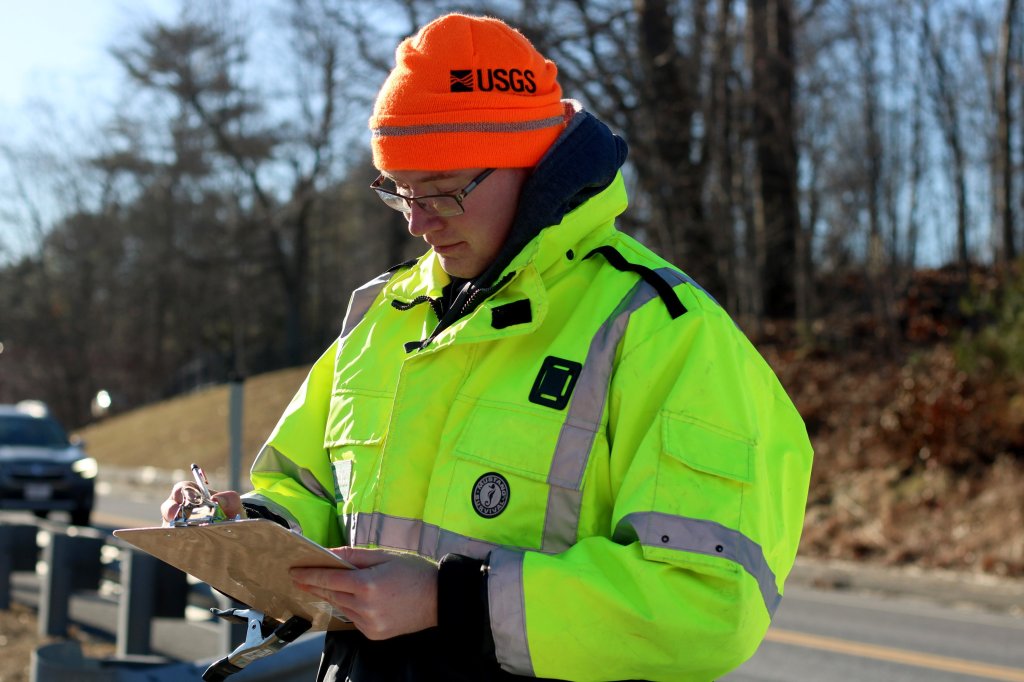
Stewart, chief of the Hydrologic Monitoring Branch in the New England Water Science Center of the United States Geological Survey, was on vacation when he and other USGS crew members were issued an urgent mission this week by the Federal Emergency Management Agency. Their orders were to mark and document, as precisely as possible, just how high the floodwaters had gotten at numerous data points along Maine’s flooded waterways.
“These are what we call critical perishable data, and when that data disappears, you can’t get it afterward,” Greg Stewart said Thursday while working to mark floodlines on the Kennebec River in Augusta, Farmingdale, Hallowell and Gardiner. “You can’t go back, in three weeks or a month from now, and find these marks. And if you can’t do that, it’s not valuable.”
Even as the Stewarts worked Thursday to document to the worst flood in Maine on record since in 1987, thousands of Mainers were still reeling from the fallout of Monday’s mammoth storm.
The city of Gardiner’s Public Works crew cleans up debris on Maine Avenue after the flooding of the Cobbosseecontee Stream and Kennebec River subsides Thursday in Gardiner. Anna Chadwick/Morning Sentinel
As of Thursday evening, about 65,000 of Central Maine Power’s 674,000 customers remained without power. Of those, about 24,900 outages remained in Kennebec County’s 74,000-customer base. Nearly 500,000 customers lost power at some point during the last three days, after the storm pummeled Maine with high wind gusts and between 3-5 inches of rainfall for most local communities.
Flooding on the Kennebec River reached its peak overnight Tuesday into Wednesday, devastating low-lying areas across the region.
According to the USGS website, the Kennebec River in Augusta reached 26.92 feet Tuesday evening at 7:42 p.m. On Monday at 1:54 a.m. before the water started rising, the Kennebec had been at just 3.78 feet. That means the river rose by 23.14 feet over the two days. By Thursday at 5:24 p.m. the water had receded to 11.92 feet.
The Androscoggin River also reached near-record heights. The USGS data show the Androscoggin reached a height of 20.27 feet at 2:30 a.m. Wednesday. On Monday at 12:15 a.m. before the water started rising, the river had been at just 6.51 feet. By Thursday, the water had receded to 12.02 feet at 4:45 p.m.
MARKING THE FLOODLINES
The efforts of the Stewarts on Thursday morning were intended to provide information which, when compared with past flooding events such as the massive 1987 flood, will be used to inform decision-making and planning in communities, preparation for emergencies, and a range of other uses intended to protect lives and property.
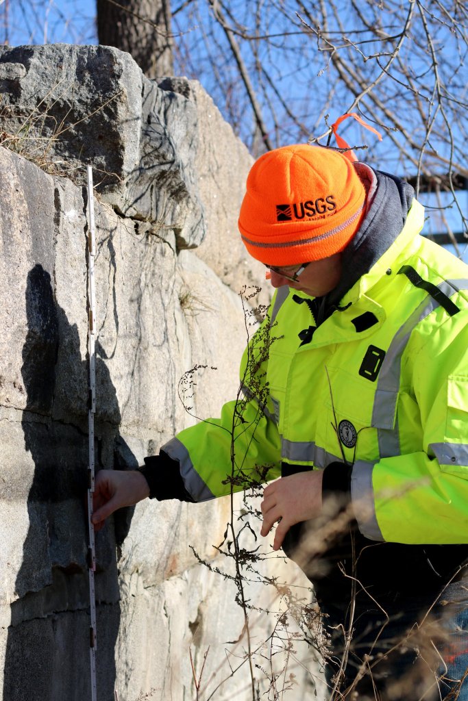
But without good data, good planning and preparation can’t happen. That’s why the Stewarts, as well as nine other two-person USGS crews, were out checking on river flow gauges and following riverbanks this week, searching for usually-faint lines left behind on trees, rocks, buildings and other riverside-surfaces, of silt and debris that, to a closely trained eye, show just how high the water got at the height of the flooding. And those visible floodlines don’t stick around long, thus the urgency to find them as soon as floodwaters recede enough they can be safely reached.
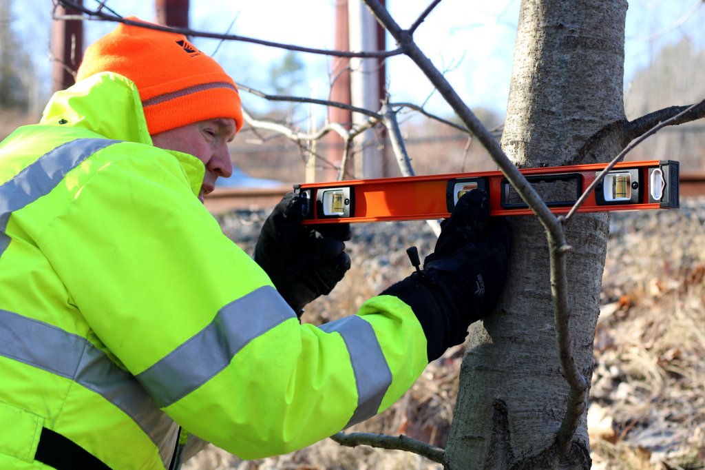
Greg Stewart points to and documents high water marks Thursday while they are still visible near Maine Avenue in Gardiner. Stewart, who works for the New England Water Science Center of the United States Geological Survey, was there to survey the flood levels of the Kennebec River in the aftermath of Monday’s historic storm. Anna Chadwick/Morning Sentinel
The data helps determine where changes should take place in building codes to help communities be more resilient, where evacuation routes should be, where and how high bridges should be, and help with future flood forecasting and predicting the severity of floods.
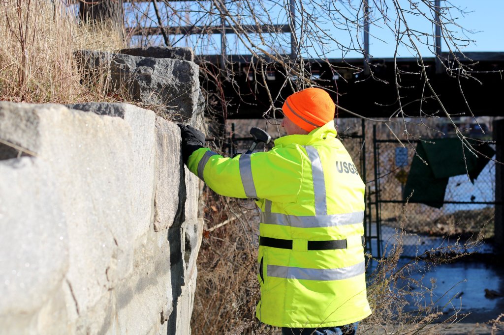
Crews mark the high water marks, at many of the same sites where floodlines were documented following the 1987 flood, with marking tape and USGS-labeled discs, taking photographs of each site with a sign with descriptors on it meant to help a survey crew to find them. That survey crew will, once all the spots are marked, document the marks with GPS coordinates within a few months. Stewart said it would take too long to document them all now before they disappear, so for now they mark the spots, which are documented and recorded by a survey crew later.
The current markers are loaded into the USGS’s short term network, or STN, with photographs from each meant to help the sites be located again in the future.
The data collected will be used, among other ways, to analyze FEMA flood insurance maps to check their validity. If they show those flood insurance maps, which are used to guide planning across the nation, the maps could be revised to reflect the updated data. Stewart said rivers can change over time, both on their own and due to changes made by humans, such as the construction of new bridges or other structures, which can impact how bodies of water flow.
Stewart said the recent flood appears to have been a 25- to 50-year flood, short of the 1987 flood that was deemed a 100-year flood. He said a 100-year flood is so-called because its probability of occurring over the course of a year is 1%. Or, if that percentage is converted to a number of years, once in a 100 years. He said a 25- to 50-year flood (like the one that just occurred) has a probability of happening, in a given year, of 2-4% — still very rare.
An onlooker photographs the Kennebec River on Tuesday as it floods Fort Halifax Park in Winslow. Rich Abrahamson/Morning Sentinel
The flood was especially unique in that it involved both rainwater and snow melt, combined with unseasonably high temperatures, unusual for this time of year, but more common in the spring when it is normally warmer. Stewart said snow became so inundated with rain it turned to liquid as well, and the combined melted snow and rainwater filled some tributaries leading into the Kennebec and other Maine rivers.
“Snow (melt) is a huge factor, normally we have that in the spring,” said Stewart, a Winthrop resident. “This was not only a fair amount of rain, on snow, but it was very, very warm.”
Stewart said water levels behind the Wyman Dam in Bingham that holds the Kennebec River were high, as they normally are this time of year as more water is held back for power generation purposes. When the storm occurred, that water was released, adding to the growing flow of water that overwhelmed riverbanks and entered buildings in several Kennebec River communities along the way.
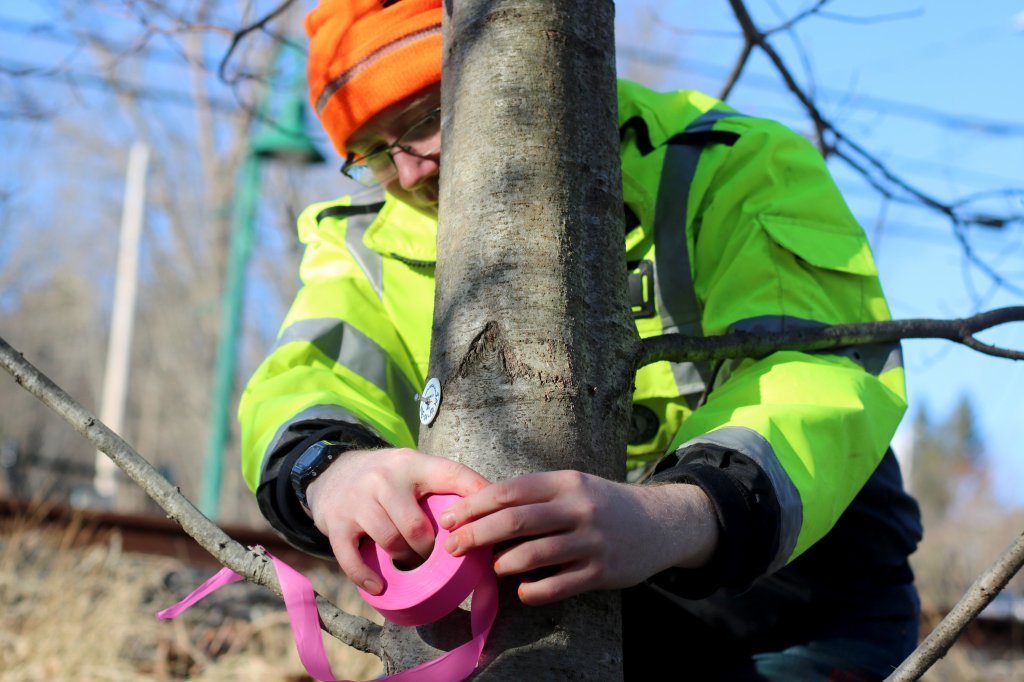
To determine how high the water got along the way Greg Stewart, accompanied by his son, Alex, a senior studying civil engineering at the University of Maine who volunteered to help Thursday, first looked for silt and debris lines, then looked for evidence to confirm that’s where the water, and not just a stray wave, reached. That evidence included whether grass was upright or flat, whether leaves were loose or wrapped around grass or branches, and other indicators unseen by an untrained eye.
Alex Stewart uses pink tape on Thursday as an indicator of high water marks to make it easier for surveyors to later along the Kennebec River in Farmingdale. Stewart, a University of Maine student studying civil engineering, was helping his father, Greg Stewart, who works for the New England Water Science Center of the United States Geological Survey. They were there to survey the flood levels of the river in the aftermath of Monday’s historic storm. Anna Chadwick/Morning Sentinel
USGS field crews are expected to be out Dec. 20 to 23 and Dec. 26 to 30, looking for evidence that will tell scientists and communities how high the floodwaters reached in the heavy rains that struck much of the East Coast.
They’re also checking river flow gauges, including ones in Sidney, Augusta and Gardiner, which tracked water heights throughout the storm, providing updated data every 15 minutes.
Preliminary USGS data indicated the flooding, still ongoing is places, is likely the second worst in the state’s recorded history.
LOCAL DAMAGES
Meanwhile, several parts of Somerset County are reporting severe flooding damage, according to Mike Smith, the county’s emergency management director.
Mercer, Anson, Solon and Caratunk appear to be the hardest hit, Smith said. Areas of Fairfield near the Kennebec River were also evacuated Tuesday as the river rose.
In Anson, where the Carrabassett and Kennebec Rivers converge, firefighters had to use canoes to rescue residents trapped in their houses by flooding, according to Smith.
“We actually had people coming out of windows,” Smith said. “They felt their houses sinking. They ended up being secluded down in there.”
Smith was also able to help the town of Norridgewock coordinate with the Red Cross to set up an emergency shelter.
“We try to keep every emergency local,” he said. “When it exceeds that, we become the conduit to find those municipalities the resources that they need.”
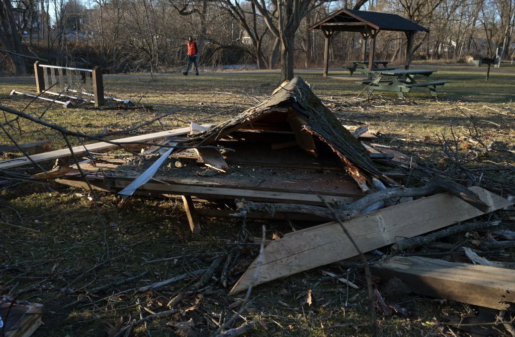
A destroyed kiosk, shown Thursday at Mill Island Park in Fairfield, was struck by the recent storm that flooded the nearby Kennebec River. A fallen tree was next to the rubble. Other trees were also down in the park. Rich Abrahamson/Morning Sentinel
In Farmingdale, officials had to rescue a 79-year-old man from his car that was trapped in at least 4 feet of river water that washed onto Main Street from the Kennebec River.
The man, who is in stable condition now, drove through the flooded areas of Main Street at around 4:30 p.m. Tuesday and became trapped for around half-an-hour near Martin’s Barber Shop, according to Mike LaPlante, Farmingdale’s Assistant Fire Chief.
LaPlante said the Kennebec Masonic Lodge gave the volunteer fire department a small rescue boat to use to get into small, tight waters, which LaPlante used to save the man from his car. LaPlante estimates the man waited for rescue in water that was up to his neck when sitting down.
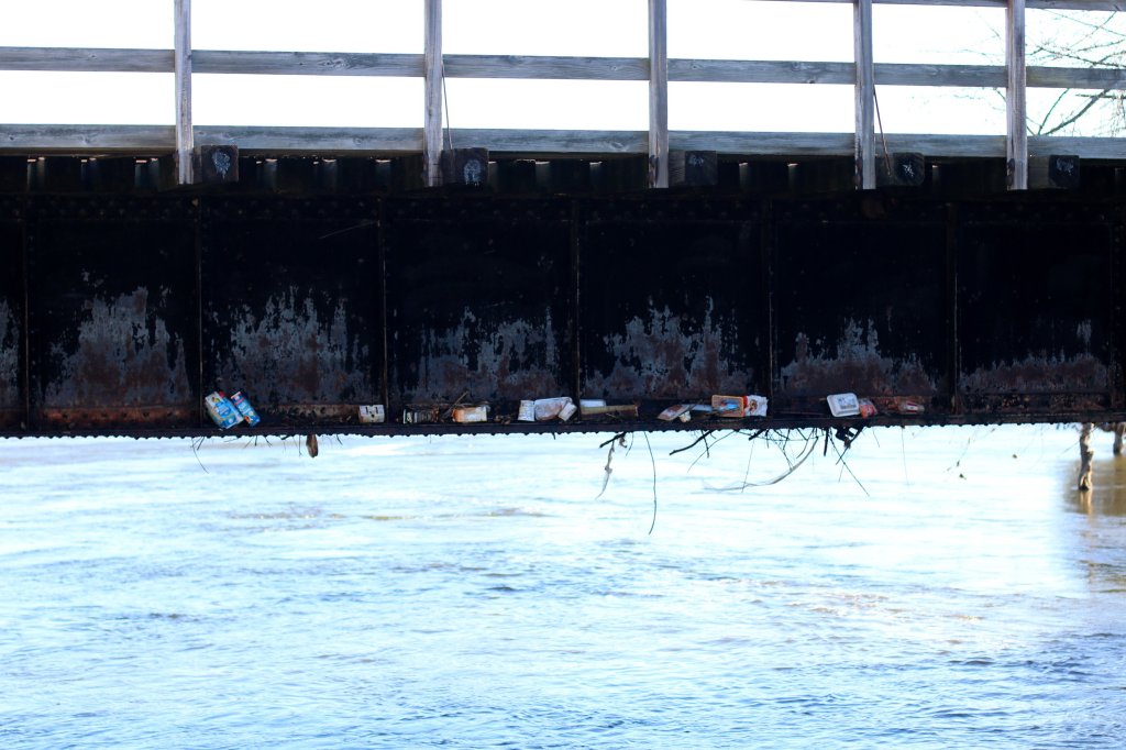
Grocery store items, such as raw chicken and milk cartons, are seen Thursday under a bridge after the flooding of Maine Avenue in Gardiner. The Hannaford supermarket, at 40 Maine Ave., was severely flooded by Kennebec River waters. Anna Chadwick/Morning Sentinel
With the parking lot at the Gardiner Hannaford still flooded enough for people to canoe in, residents might have to wait weeks before the store reopens.
Crews attempted to explore the damage of the store on Thursday morning and found canned and boxed goods scattered around the aisles in a mess that could potentially take weeks to clean up, along with whatever damage the store sustained from the high flood waters.
Chris Hughes, a part-time deli employee at the Gardiner Hannaford, posted a message on Facebook to spread the word from the Hannaford management team, which said there is “no estimate on a reopening timeframe” until the store’s structure and equipment can be assessed.
In the meantime, management told the store’s employees that they can continue working at other locations in central Maine. Nearby are the Hannaford stores located at 118 Cony St. in Augusta, 29 Whitten Road in Augusta and 399 Main Street in Winthrop.
Morning Sentinel staff writer Jake Freudberg and Kennebec Journal staff writer Emily Duggan contributed reporting.
Copy the Story LinkSend questions/comments to the editors.

Success. Please wait for the page to reload. If the page does not reload within 5 seconds, please refresh the page.
Enter your email and password to access comments.
Hi, to comment on stories you must . This profile is in addition to your subscription and website login.
Already have a commenting profile? .
Invalid username/password.
Please check your email to confirm and complete your registration.
Only subscribers are eligible to post comments. Please subscribe or login first for digital access. Here’s why.
Use the form below to reset your password. When you've submitted your account email, we will send an email with a reset code.