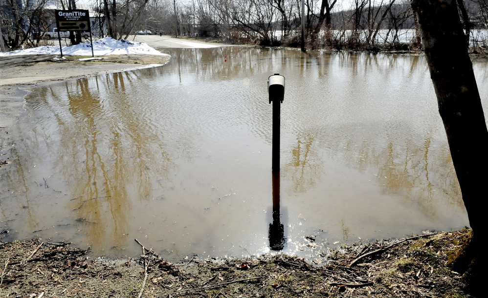
DEXTER — Downtown businesses and several roads through town were closed Wednesday after the Sebasticook River East Branch, which runs under a part of the town, including several businesses, flooded.
As the northern snowpack melted, helped by Tuesday’s rain, water rushed into central and northern Maine’s rivers, forcing many, such as the Sebasticook, over its banks.
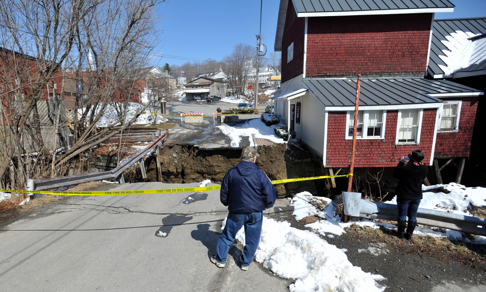
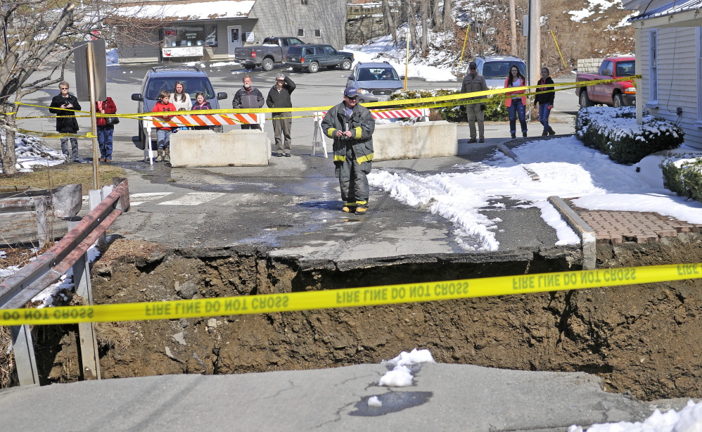
In downtown Dexter, the Dexter Historical Society Grist Mill Museum, which dates to 1854, teetered over the river where a large section of road was washed out, creating a dropoff of about 15 feet into the water.
On Main Street, the Fire Department spent most of Wednesday afternoon pumping water out of the Town Office, which is also built above the river.
Dozens gathered to watch the river Wednesday afternoon as emergency workers tried to keep the damage from getting worse.
“It’s not a big river. It’s just that all the runoff, rain and snowmelt are trying to go into that little river,” said Fire Chief Matt Connor “We’re keeping an eye on it and trying to keep people away from the areas that have washed out.”
The National Weather Service estimated Wednesday that the water level was at 10.3 feet, which is above the flood level of 9 feet.
There is no exact measure of the river’s water level because a gauge farther south, on the Sebasticook, in Pittsfield, was removed earlier this year by the U.S. Geological Survey because of mandated federal cuts, according to Mike Kistner, a meteorologist at the National Weather Service in Gray.
The sequestration cuts removed seven to 12 other gauges around the state. As a result, the weather service plans to stop issuing river-specific flood warnings for the Sebasticook. The service will continue to issue flash-flood and flood warnings for broader geographic areas that include communities along the Sebasticook, he said.
About an inch of rain and an inch of snow fell in central and western Maine on Tuesday and through the night to Wednesday morning, melting the heavy snowpack.
The flood warning in Dexter was lifted at 5 p.m. Wednesday, but it remained in effect for the Sebasticook in the Pittsfield area, as well as the Kennebec, particularly in Skowhegan, north Sidney and Augusta. Warnings also included the Piscataquis River above Dover-Foxcroft, where the river was about a foot over flood stage.
Businesses on Main Street in Dexter were closed for most of the day as a precaution against flooding. The Town Office, which is also on Main Street, was evacuated.
“It runs right under us. The river is literally going through the bottom of the store,” said Melodie Stanhope, a clerk at Tillson True Value Hardware on Main Street. The store closed for about an hour and a half Wednesday but reopened during the afternoon. She said there was no water damage or flooding.
“We knew people might need emergency supplies, so we came back,” she said.
Several roads and bridges cross the river, most of which were closed and won’t reopen until the water level subsides, Assistant Fire Chief Rick Stocker said. At one crossing, the water uprooted a culvert on Lincoln Street and forced the metal pipe up through the road. Several people stopped to take pictures.
“I was just at work, and everyone was talking about it. I wanted to come take a picture to send to my daughter in Connecticut,” said Dennis Hoskins, 66, a resident.
At the intersection of Water and Lincoln streets, crowds also gathered.
Erin Braley of Plymouth and her friend Cheyann MacMullen of Pittsfield said they never had seen so much water in the river.
“It’s the first time I’ve seen it like this. I just can’t believe how much damage there is,” said MacMullen, 31.
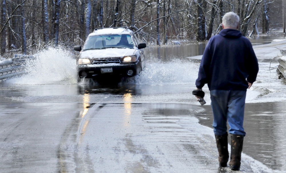
The weather service issued repeated warnings Tuesday and Wednesday, urging motorists not to drive through flooded areas and pedestrians not to walk through them. “It is impossible to know if the road is safe for travel,” the service said. “Turn around, don’t drown!”
Conditions were not as severe in every part of the state as they were in Dexter, although there were other reports of high water and flooding.
“We have a bunch of rivers flooding in Maine right now, although it is mostly minor floods,” said James Brown, a hydro-meteorological technician for the National Weather Service in Gray, on Wednesday.
Both the Carrabassett and Kennebec rivers were near peak flow and rising Wednesday, and there was significant flooding along the Augusta waterfront, as well as in Hallowell and Gardiner.
Smaller rivers – including the Sandy River, which originates in Sandy River Plantation in Franklin County and meets the Kennebec in Norridgewock; and the Sebasticook, which originates in Dexter and runs into the Kennebec in Winslow – had elevated water levels that were high enough to cause damage.
In Norridgewock, flooding on Sandy River Road was reported around 6:30 a.m., in an area where there are no homes, although the road is used as a throughway by many people, according to Town Manager Michelle Flewelling.
The river also contributed to flooding on Sawyer’s Mill Road in Starks, where the road was closed Tuesday night and reopened to one lane of traffic on Wednesday.
Rachel Ohm can be contacted at 612-2368 or at: rohm@centralmaine.com
Send questions/comments to the editors.


Comments are no longer available on this story