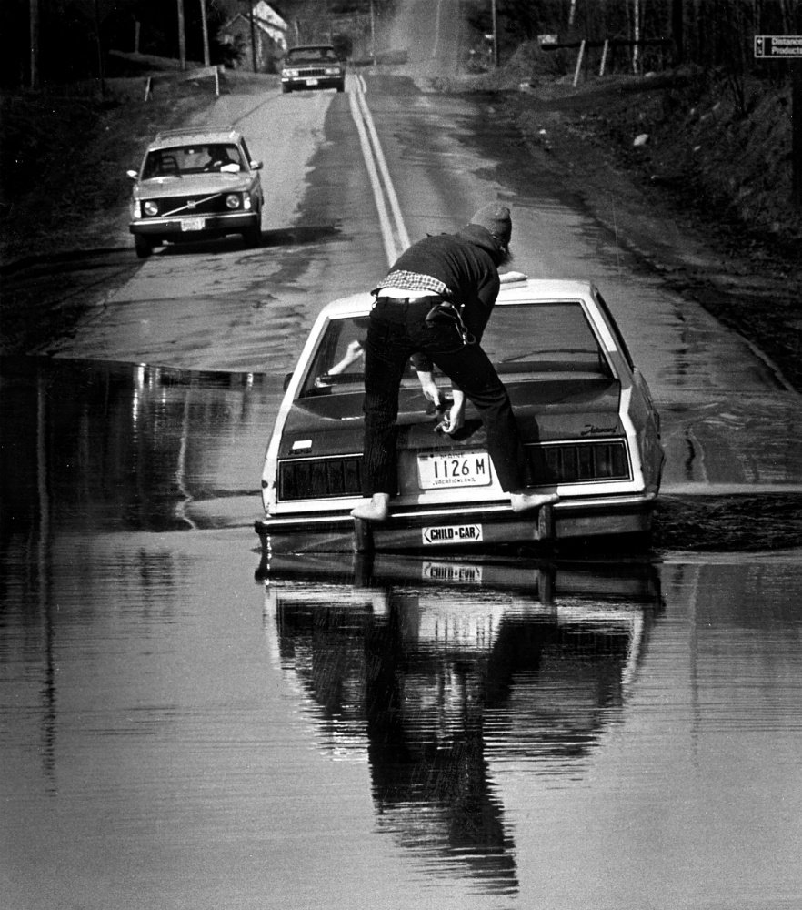
This file photo from the April 1987 flood shows David Hall waiting for a tow on Route 139 in Unity.
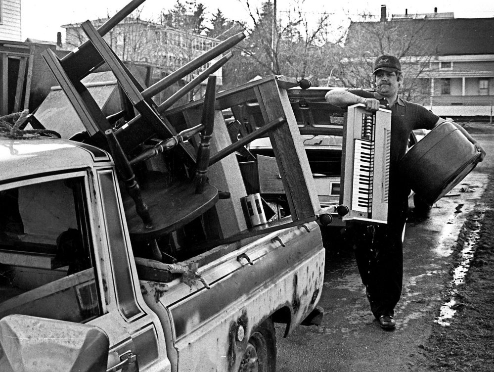
This file photo from the April 1987 shows Howard Michaud moving his belongings from Water Street in Waterville during the flood.
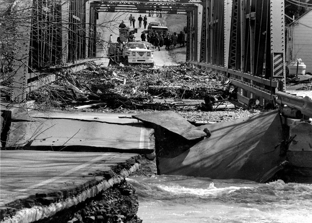
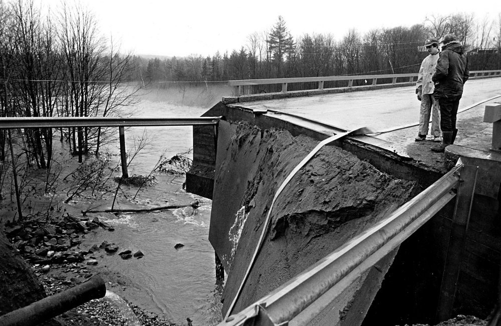
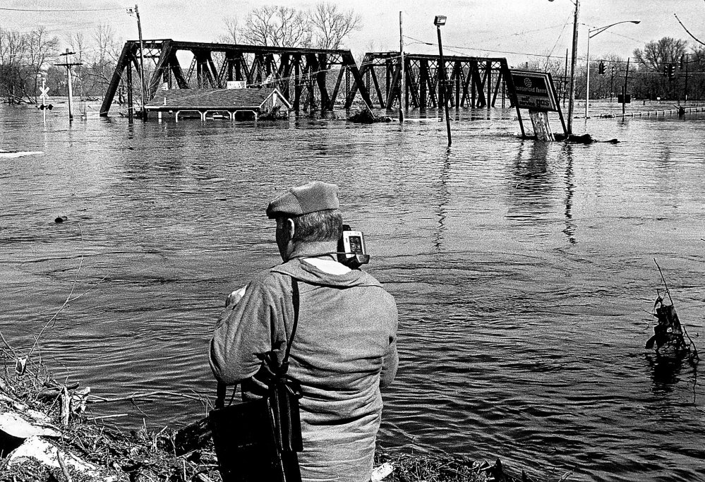
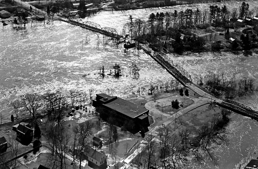
This file photo from the April 1987 flood shows damage on the three bridges connecting Benton and Fairfield during the flood.
This file photo from the April 1987 flood shows the Bond Street Historic District that was recently added to the nation Register of Historic Places.
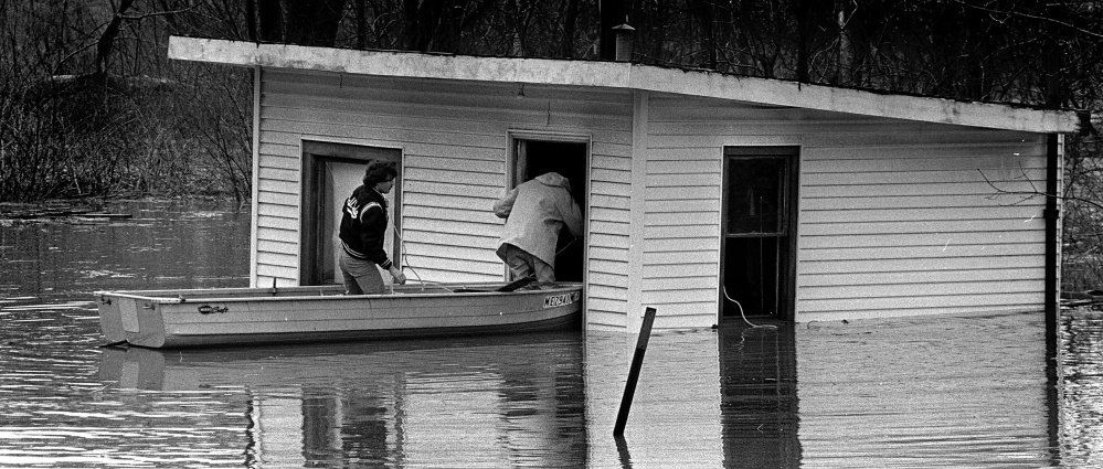
This file photo from the April 1987 flood shows two people in a boat looking at damage to a building in an unidentified location.
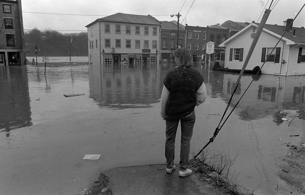
This file photo from the April 1987 flood shows an unidentified woman looking toward Water Street from the corner of Central and Second streets in Hallowell.
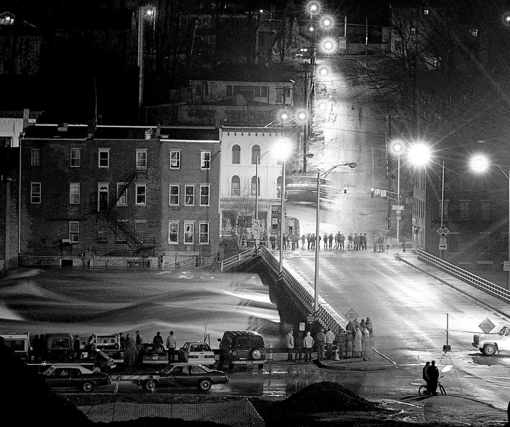
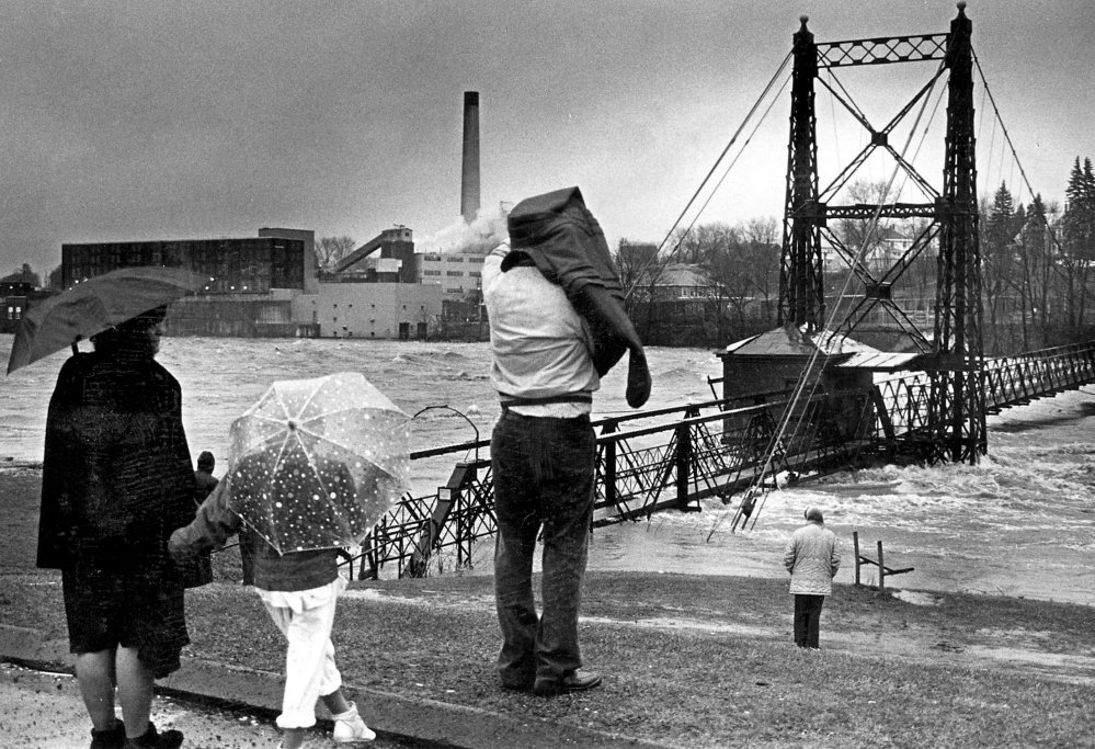
This file photo from the April 1987 flood shows people watching water flowing under the Calumet Bridge at Old Fort Western in Augusta. Thirty years ago the bridge was called the Father Curran Bridge.
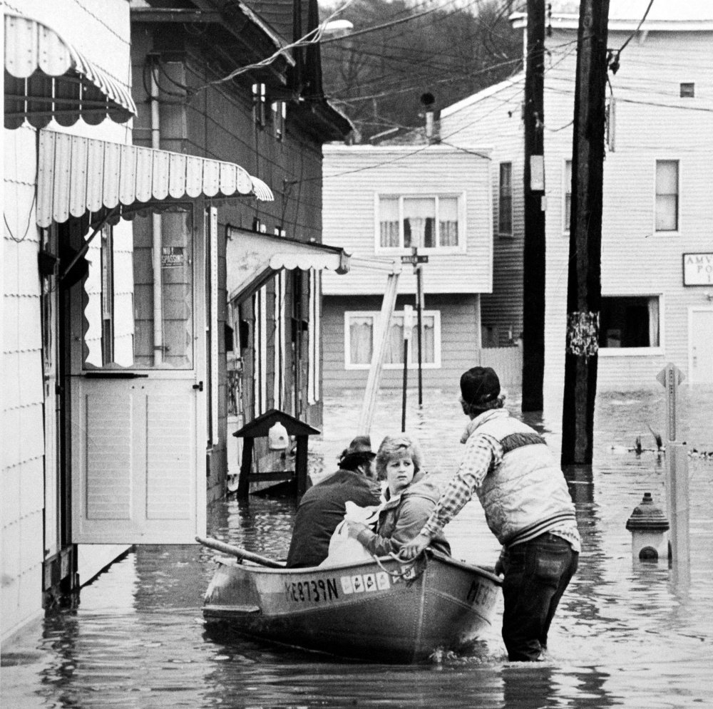
This file photo from the April 1987 flood shows Marie Veilleux being evacuated from a Bond Street building in Augusta.
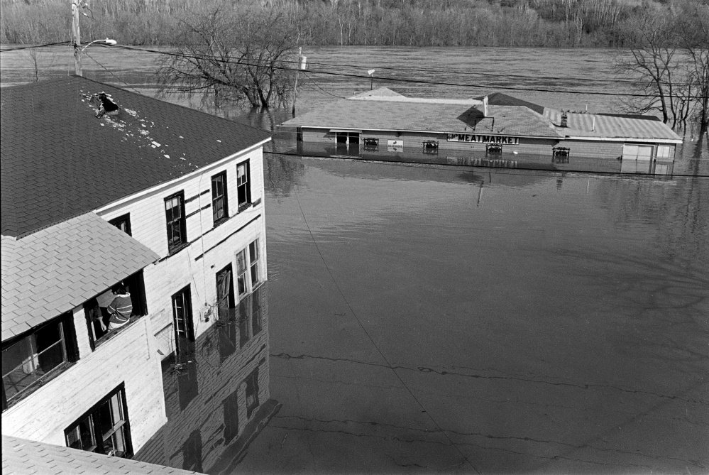
This April 1, 1987 file photo shows the Kennebec River flooding over Water Street in Hallowell. Fido's Meat Market, at top right, is the currently the site of the Cafe de Bangkok and Brews and Views restaurants.

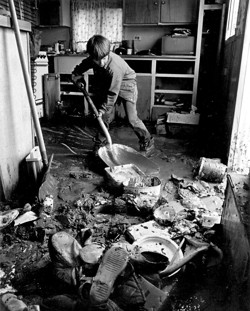
Shawn Beckwith shovels out his grandmother's mobile home during the 1987 flood.
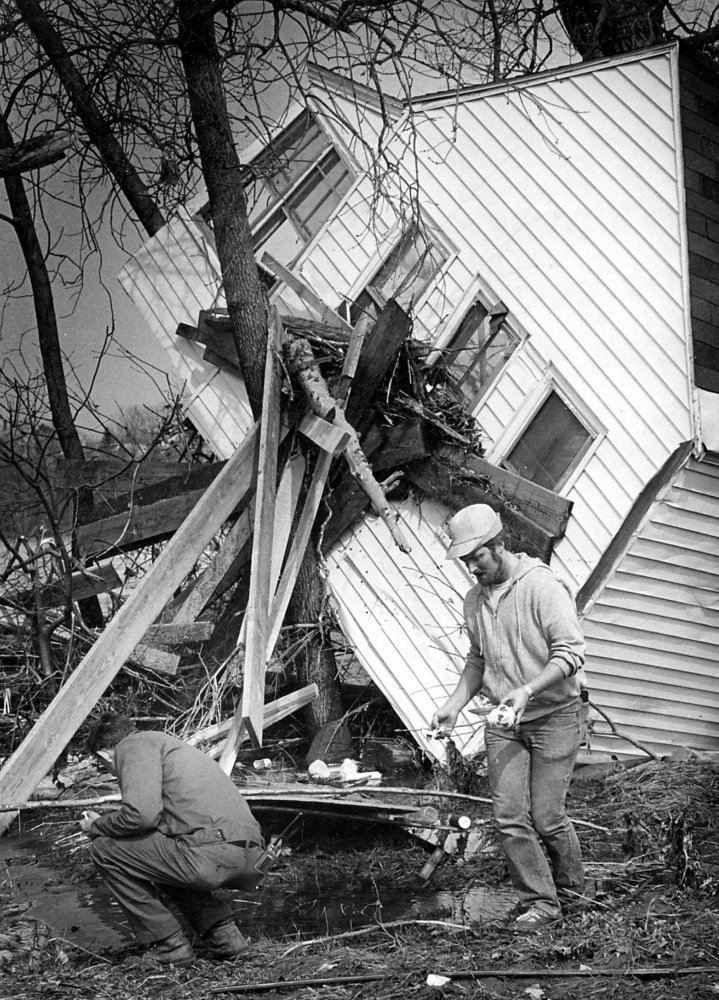
This file photo from the April 1987 flood shows Tom Pelotte and Bill Shepherd picking up pieces of china from the home of Tom's mother on Lithgow Street in Winslow.
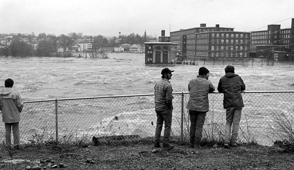
This file photo from the April 1987 flood shows Kennebec River running high between Winslow and Waterville.
This file photo from the April 1987 flood shows Kennebec River running high at the Two Cent foot bridge between Waterville and Winslow.
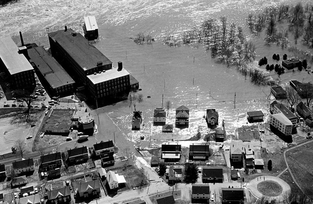
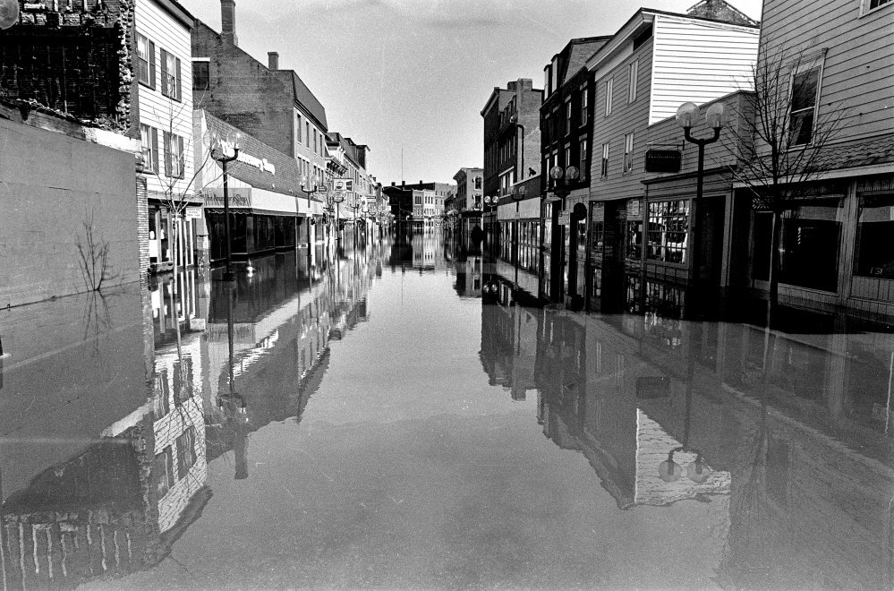
This file photo from the April 1987 flood shows Kennebec River flooding Water Street in Waterville.
This file photo from April 1987 shows Kennebec River flooding in Winslow.
This file photo from April 1987 shows Kennebec River flooding Winslow.
This file photo from April 1987 shows Main Street in Strong over the Sandy River. Pipe, at left in picture, was the town's water supply.
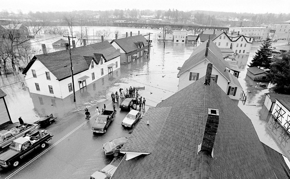
This file photo from the April 1987 flood shows Water Street in downtown Gardiner.
The original Fort Halifax in Winslow was washed away in the flood of 1987. The fort was located just beyond the bridge next to Bee's Diner, which survived the rising waters.
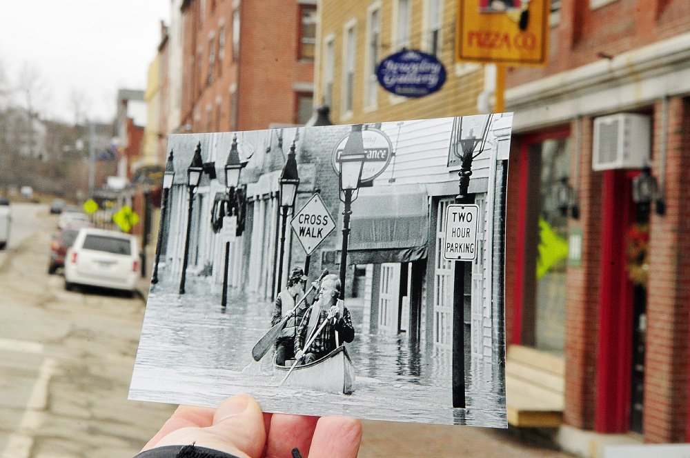
The water had receded when this photo was taken in 2012, but the street looks similar to when Fred Field photographed Sumner "Sam" Webber, left, and John Jacques paddling on Water Street just past Central Street after the Kennebec River flooded downtown Hallowell in 1987.
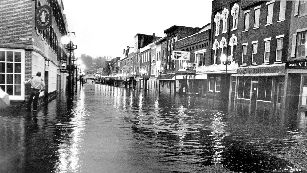
This file photo from the April 1987 flood shows Water Street in downtown Gardiner.
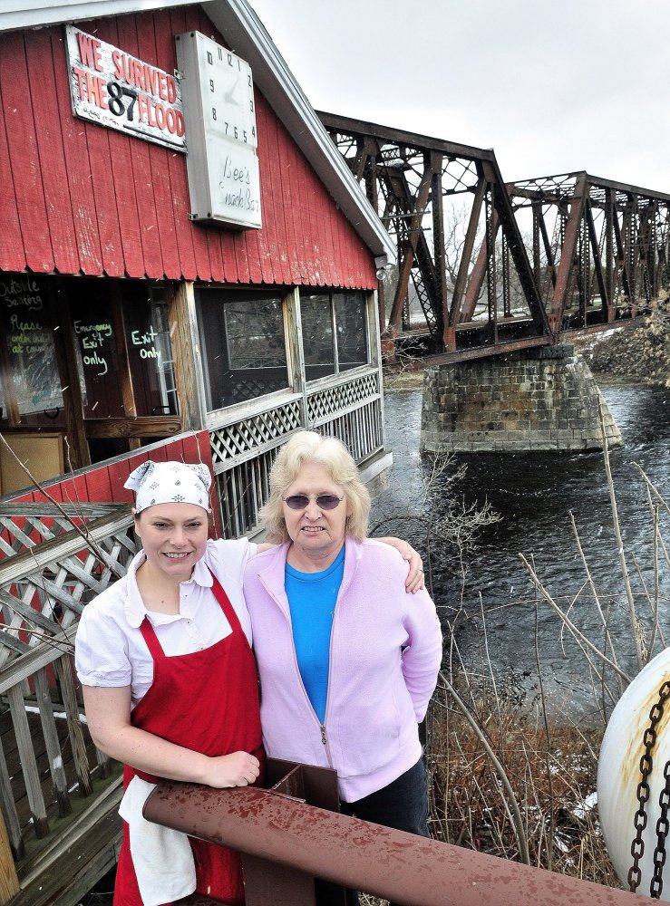
This 2012 file photo shows Ryan Willette, left, and her mother Evelyn Willette standing outside their restaurant Bee's Snack Bar beside the Sebasticook River in Winslow. The business narrowly escaped being swept away during the flood of 1987.
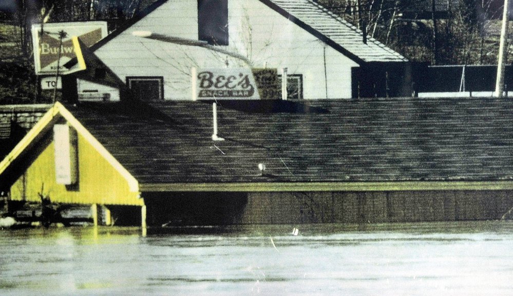
This photograph was taken of Bee's Snack Bar in Winslow at the height of floodwater during the flood of 1987. The business survived the flood that swept away seven nearby homes on Lithgow Street.
This file photo from April 1987 shows flooding in Skowhegan.
This file photo from the April 1987 shows flooding in Wilton.
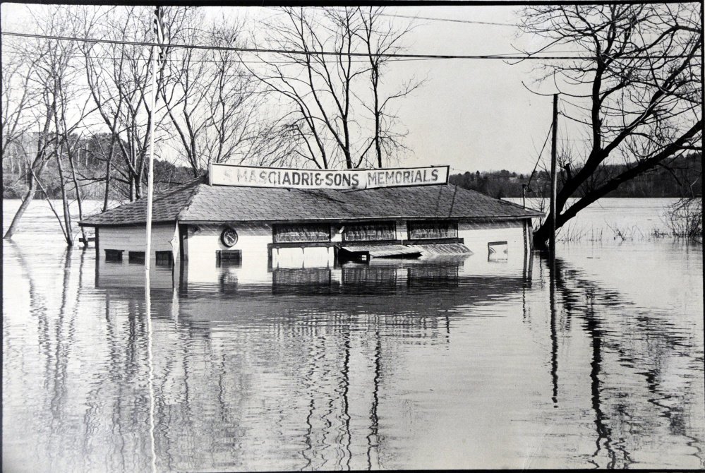
This file photo from the April 1987 flood shows the Kennebec River nearly covering S Masciadri & Sons on Water Street in Hallowell.
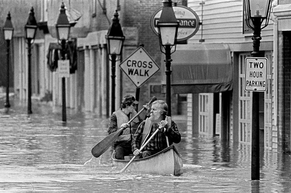
This April 1987 file photo Sumner "Sam" Webber, left, and John Jacques paddling a canoe on Water Street just past Central Street after the Kennebec River flooded downtown Hallowell.
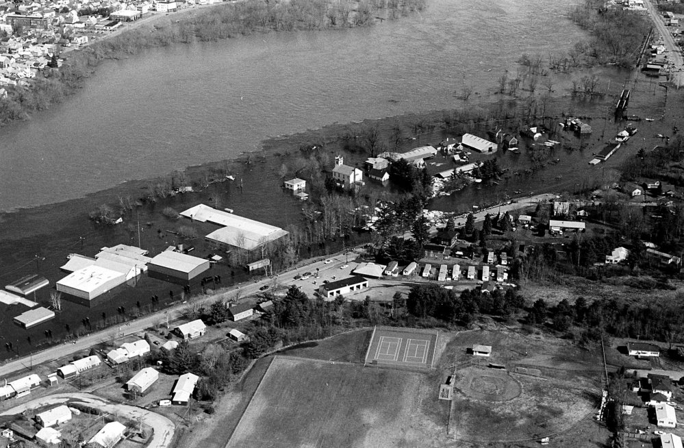
This file photo from April 1987 shows Kennebec River flooding Fairfield.