The "Historical Atlas of Maine" is 208 pages that cover a broad variety of topics.
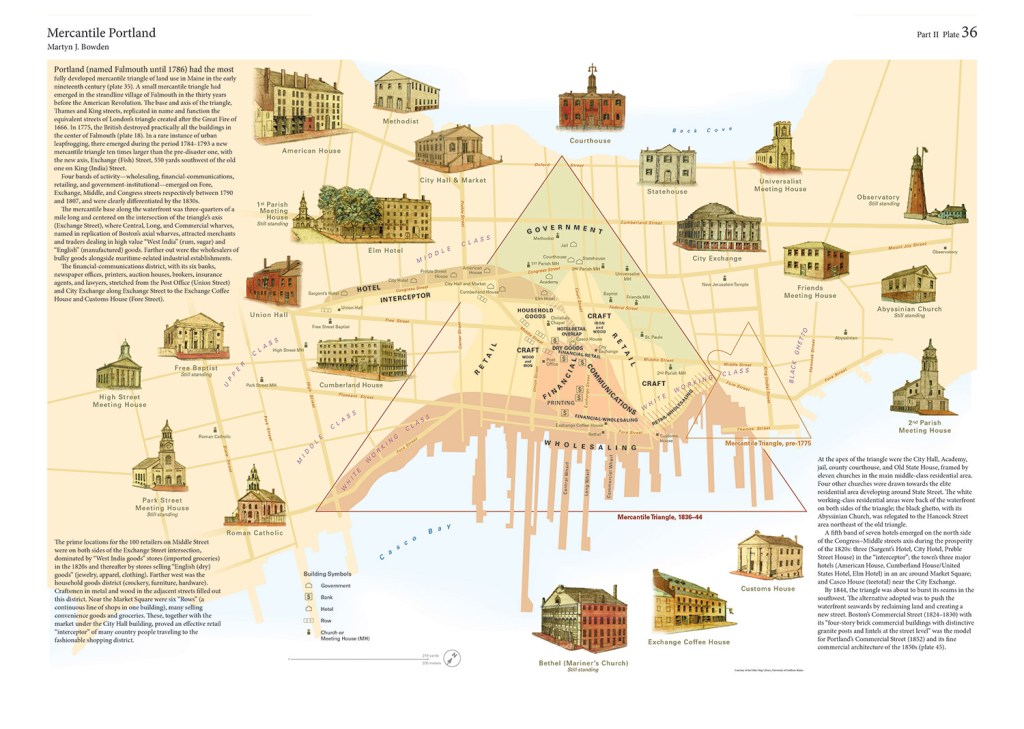
This map details the most fully developed mercantile triangle in Maine in the early 19th-century.
The atlas pulls together the research and writings of more than 30 people.
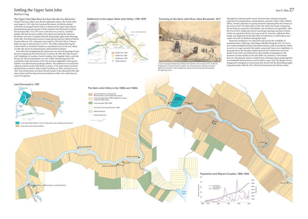
Settling the Upper Saint John details settlement of the Saint John River Valley from the late 1700s to the mid-1800s. The two-page map shows specific developments along the river from Fort Kent to past Madawaska in the 1830s and 40s.
The book features historical maps. A co-editor, Stephen Hornsby, will give a talk Dec. 10 from 6 to 8 p.m. at the Osher Map Library and Smith Center for Cartographic Education in Portland.
The "Historical Atlas of Maine" is priced at $65 until the end of the year, when the price will go up to $75.
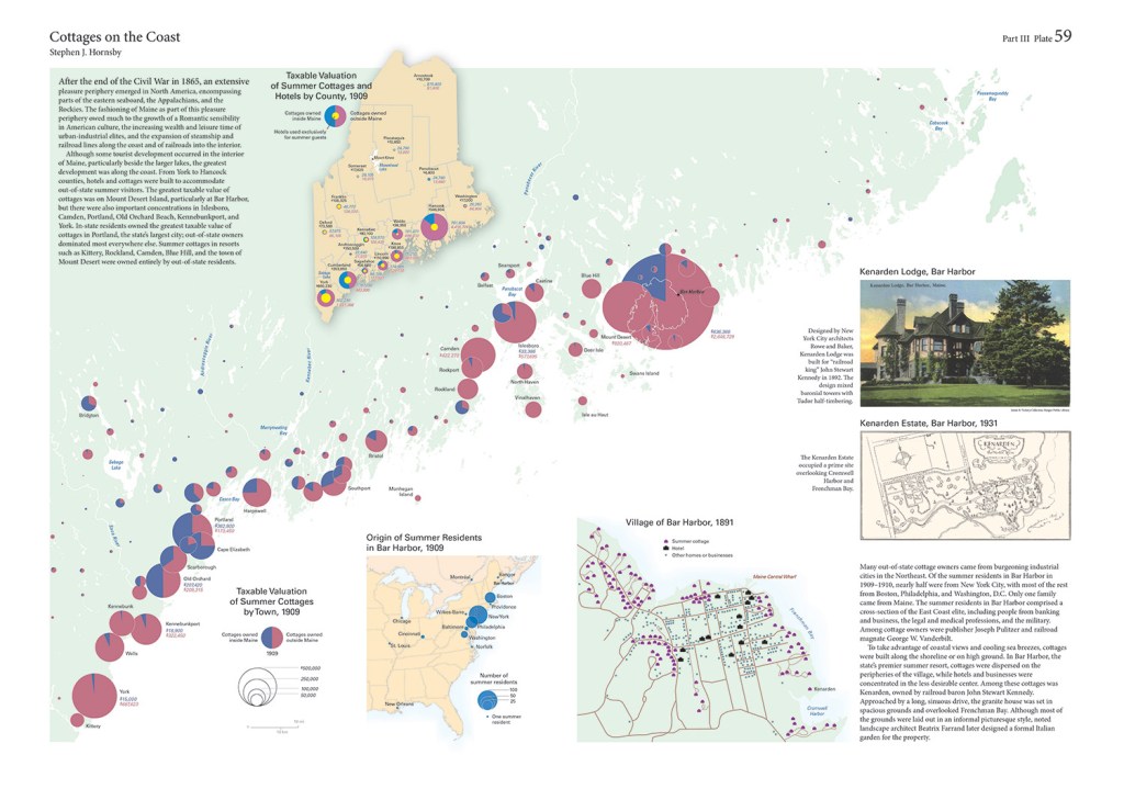
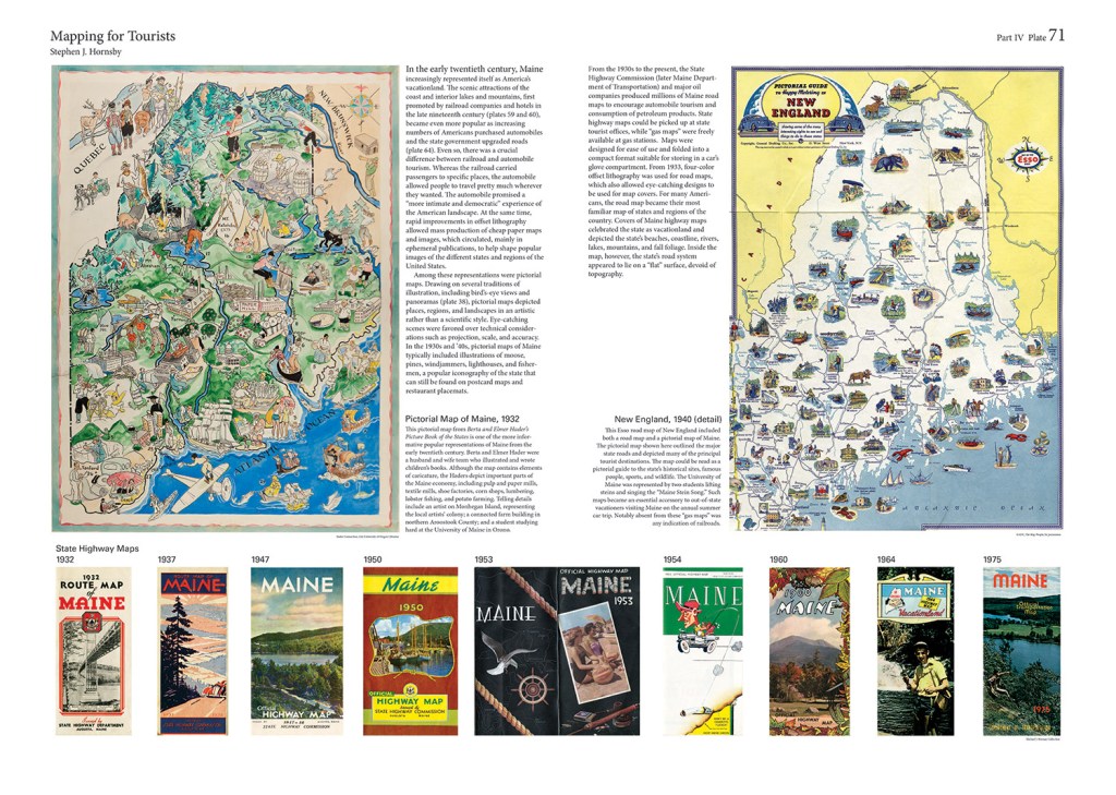
Cottages on the coast are the focus of these pages, which show how each map is tailored for a specific topic.

Burton Hatlen was a self-described "public academic" who proposed creating a comprehensive historical atlas of Maine.

Richard W. Judd, a University of Maine professor who is one of the editors of the atlas. He and co-editor Stephen J. Hornsby worked on the book for more than a decade.

Stephen J. Hornsby is one of the University of Maine professors who edited the atlas.