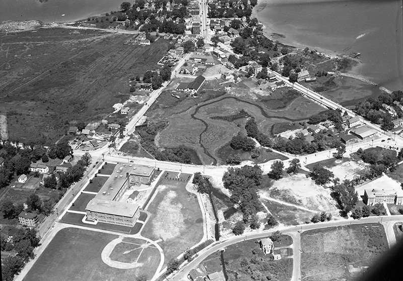
1940 or 1941: View of the Mill Creek area and the convergence of Ocean Street and Cottage Road in Knightville. South Portland High School, the current Mahoney Middle School, at lower left and Brown Elementary School on the lower right. Mill Creek can be seen running to a low tidal area that is now Mill Creek Park. The open fields in the upper left are all now shopping centers, a car dealer and South Portland's waste water treatment facility.
1949: Ocean Street and Broadway. South Portland High School on the right.
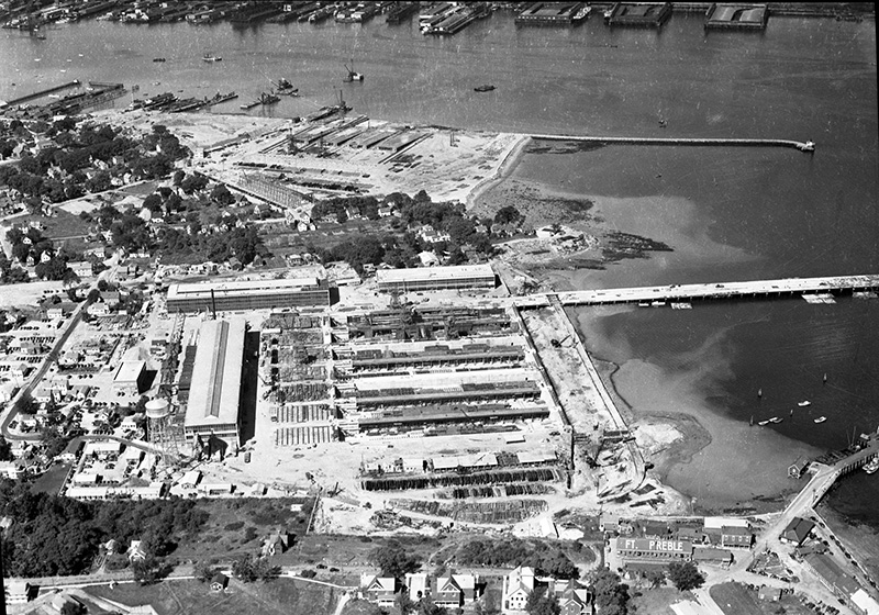
Around 1947: South Portland shipyard at Spring Point. Fort Preble is in foreground. Spring Point Marina is now on the right with the Portland Pipeline terminal. Bug Light sticks farther out into the water than it did then and wartime shipyards continue on the harbor side.
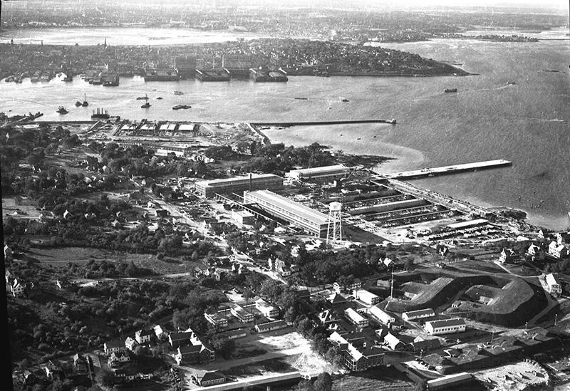
Around 1947: A fairly high altitude view of the South Portland shipyard complex at Spring Point. The earthworks and buildings of Fort Preble can be clearly seen in the foreground.
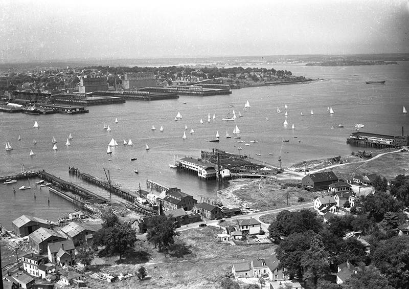
Late 1940's: Ferry Village with Front Street in foreground. Portland harbor, Grand Trunk grain elevators in background. The shipyards are just to the right out of view.
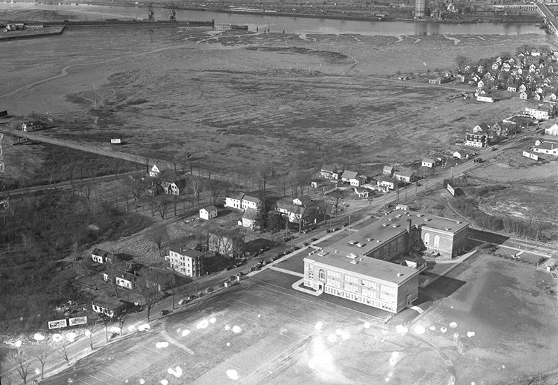
1947: Beyond the high school is now Mill Creek Park which was under construction when this photo was taken. Knightville and the Central Maine Power hydro-electric plant in Portland Harbor in center background.
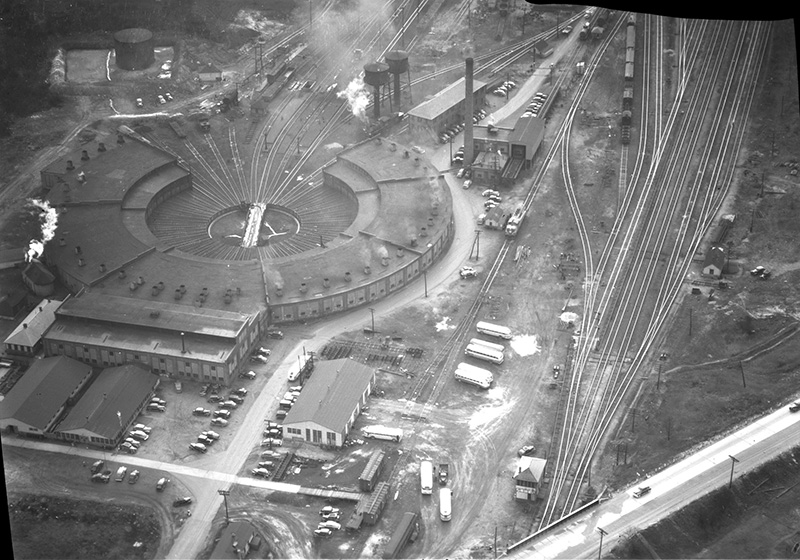
Late 1940's: Rigby Yard roundhouse with Main Street at lower right corner. The rail yard was built in 1923. The roundhouse was torn down sometime in the last decade.
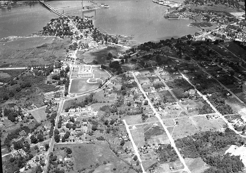
Late 1940's: Knightville and Mill Creek areas from southeast. To the right of Ocean Street are Fessenden, Boothby, Jordan, Providence avenues and Richland Street. The area is now much more densely built and forested.
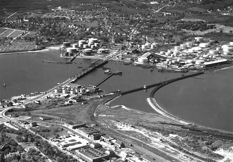
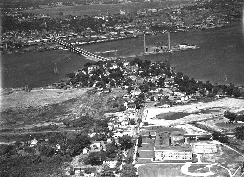
Around 1947: Taken from the Portland side of the Fore River, this shows the 'proposed site for new Vaughan's Bridge,' from northeast. Fore River at center, Vaughan's Bridge at left. Saint John Street in foreground and the oil tanks, Forest City Cemetery and Ligonia on the South Portland side of the river.
Around 1949: Sunset Park from the south. Main Street at lower right corner. New York, Pennsylvania and Massachusetts avenues at center. Sunset Park is now bounded by Main Street, the Maine Turnpike Approach and the Scarborough Connector.
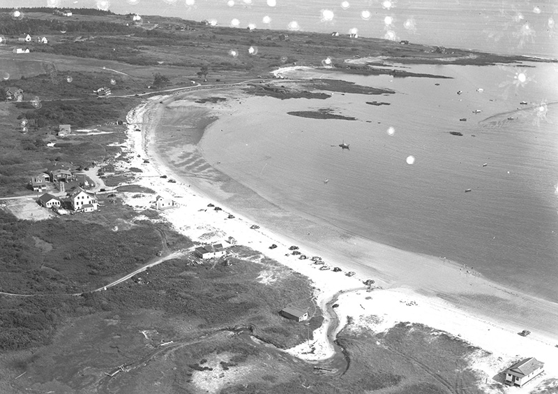
Around 1939: Not South Portland but Crescent Beach and Kettle Cove, from south. When this photo was taken, the Maine's state park system was new but Crescent Beach was not included in it. It wasn't until 1962 that the beach was added to the system and it opened to the public as a state park in 1966.
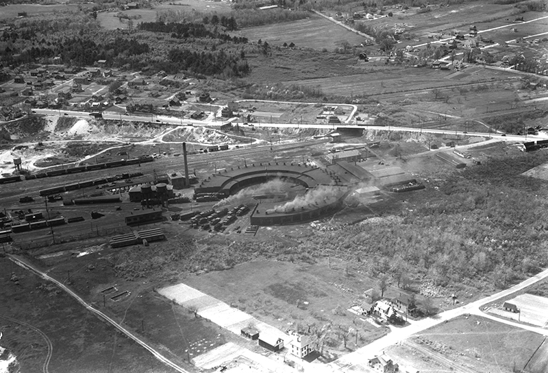
1930's: Portland Terminal Company railroad yard (Rigby Yard) from east. Locomotive roundhouse at center. Rumery Street runs along the bottom of the photo and Main Street in the middle ground. On the other side of Main Street is Thornton Heights with Broadway in background. Memorial Middle School is now where the trees and fields are in the upper left.
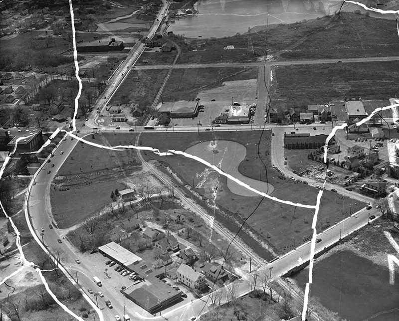
1954: Damaged view of future location of Mill Creek shopping area, from east. South Portland High School building at left. Mill Creek Park had just been completed and was dedicated that year. The lower left corner is the intersection of Broadway and Cottage Road where Otto's Pizza and, to the right, the South Portland Public Library are today.
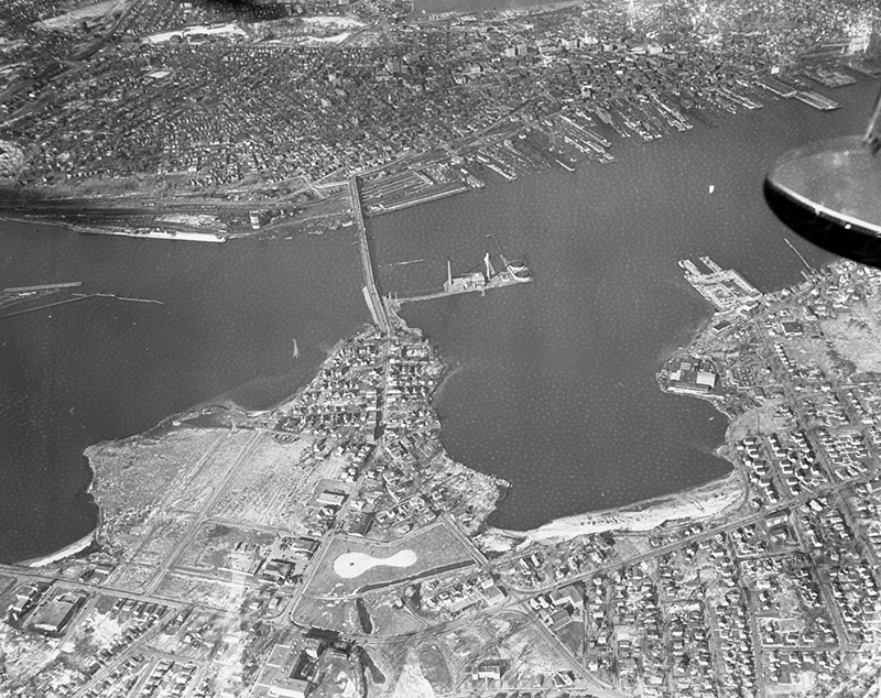
January 1955: High altitude view of the Million Dollar Bridge, Central Maine Power plant in the harbor. The new Mill Creek Park is in the lower middle of the frame. The high school is at the bottom and the armory and fire state in the lower left.
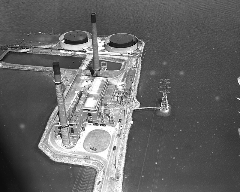
1954: Central Maine Power plant on the South Portland side of Portland Harbor.
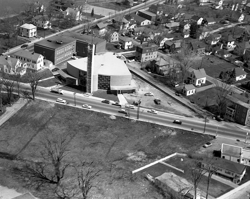
1958: Holy Cross Church on Cottage Road. When this photo was taken in August, the tower of the church was being finished with metal tiles. The church was dedicated a month later. The non-representational tiles were replaced in 1980 with a locally famous depiction of Christ. The undeveloped area in the foreground is the site of the South Portland Library. The gas station that houses Otto's at the lower right.
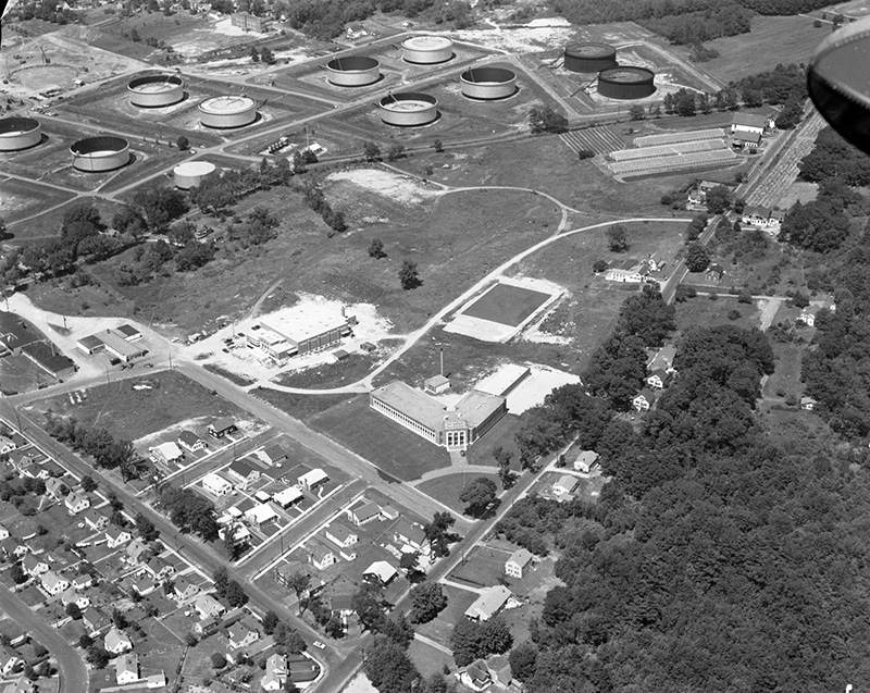
1957: South Portland High School with its new gymnasium and tank farm on the other side of Nutter Road. A farm with greenhouses stands at the corner of Nutter and Highland in the upper right and Kaler Elementary School can be just seen at the top, left of center.
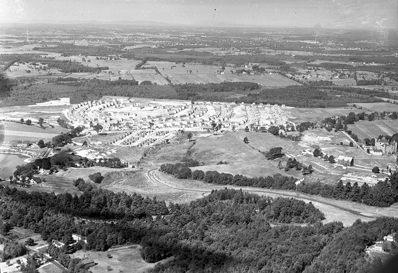
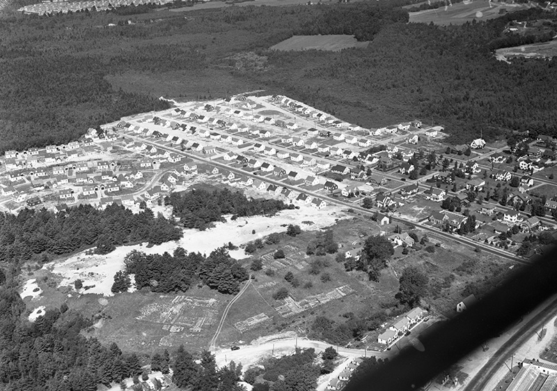
1949: Redbank Village. The Maine State Reform School for Boys can be seen at the right of the frame. On the other side of the development where there are trees and open fields is now the Portland Jetport.