


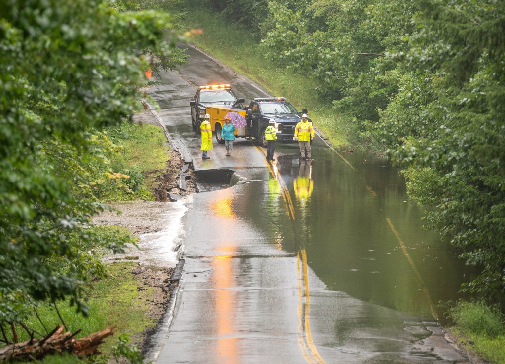
City workers check out Jackson Hill Road in Auburn after it was washed out in August following heavy rain. Andree Kehn/Sun Journal, file
Maine is getting wetter across all seasons, but it is the increasing intensity of the precipitation – and the flooded basements, crop disease, and washed-out culverts and roads that can come with it – that has climate planners, farmers, and engineers scrambling to prepare.
While the future impact of sea level rise is a top concern in Maine and other coastal states as the climate warms, the increasing frequency of extreme weather events here is already having statewide impacts.
According to the new National Climate Assessment, in the sprawling region it defines as the Northeast, the number of extreme rain or snow events is up 62%, the largest increase in the nation. Two-inch rain days were up 49% when comparing averages between 1958 and 2022, while 5-inch days were up 102%.
How does Maine stack up? The assessment’s conclusions about the Northeast are based on data from 13 states, from Maryland and West Virginia to Maine. It doesn’t specify how many heavy rain days any one state within the region has racked up.
An independent review of five long-term weather stations in Maine conducted by the state climatologist, Sean Birkel, suggests some of the regional extreme precipitation trends hold true in Maine: The number of 2- and 3-inch rain days is growing fast. The number of 4-inch rain days is increasing, too, but slowly.
Five-inch rain days may have doubled in the Northeast, but in Maine, they’re declining, Birkel said – but they’re so rare that the decline has little statistical value. Since 2000, Portland has had three 5-inch rain days, and Bangor has had one; Augusta, Caribou, and Farmington have had none.
The National Climate Assessment puts most of its Northeast focus on the here-and-now impacts of the extreme snow and rain days already happening but predicts this extreme precipitation will continue to increase in frequency and ferocity under all global warming scenarios heading into the future.
The National Climate Assessment Interactive Atlas Explorer projects steep increases in extreme rain for parts of Maine in certain dire warming scenarios. For example, Aroostook County will see an 83% jump in extreme rain days, the biggest of any U.S. county, under the 7.2-degree Fahrenheit warming scenario.
Meanwhile, the 2- and 3-inch storms happening more often in Maine now are already wreaking havoc on a state that must also wrestle with seasonal droughts, Birkel said. Pinballing back and forth between extremes, he said, can make it hard for anybody to plan for the future.
Extreme precipitation events and subsequent flooding can cause a variety of costly problems including property damage, lost tourism days, sewer overflows that contaminate drinking water and private wells, and shellfish bed closures.
Sea level rise compounds the flood risks along Maine’s coastline, but the flash flood risks posed by the increase in 2- and 3-inch rain days are being felt in Maine’s interior, too, taking a toll on Maine’s state transportation network and its economically valuable farm and forest lands.
In its 2020 report, “The Cost of Doing Nothing,” the Maine Climate Council estimated climate-related flooding from overflowing rivers and streams could cause up to $2.4 billion in total building losses and wipe out another $2.6 billion a year in jobs.
The Maine Department of Transportation began to incorporate extreme precipitation events into its design standards and planning process about seven or eight years ago when staff started to note an increase in the number of culverts being lost, chief engineer Joyce Taylor said.
Before that, the agency used to design its culverts and other transportation projects to withstand a 25-year storm, but now it designs all its new projects to be ready for a 100-year storm, Taylor said. While not indestructible, these new projects have all withstood Maine’s increasingly extreme weather.
“I tell people all the time, everyone talks about sea level rise, (but) we’re losing stuff inland,” said Taylor, who also serves on the Maine Climate Council. “I’m not losing it on the coast right now for MaineDOT. It’s inland.”
The agency is about to conduct a statewide vulnerability assessment of its infrastructure, especially its inland culverts, to see which ones need to be made bigger to allow for more water to pass during one of these forecasted extreme precipitation events – even if the structures themselves aren’t that old.
An estimated 2,300 of Maine’s road culverts valued at $76.6 million are in danger of being overtopped.
Taylor said she has nightmares sparked by the near-miss stories she has heard of vehicles, including one school bus, driving over flooded culverts that shortly after gave way. Standing water on the roadway can prevent drivers from realizing the culvert or road before them has washed away, she said.
Four culverts have failed in heavy storms so far this year, washing away roads in Jay and Cyr Plantation.
Extreme precipitation poses a risk to homeowners in an underinsured state like Maine, where less than 1% of housing units are covered by flood insurance, according to Mark Bove, a New Jersey meteorologist who works in the insurance industry and one of the assessment’s authors.
The federally run National Flood Insurance Program covers about 12% to 14% of annual flood damages in the U.S. This coverage gap leaves millions at financial risk in the Northeast as the frequency and severity of extreme precipitation events are expected to increase, according to the report.
Only two counties in the Northeast have more than 50% of housing units insured for flood. On average, 6.5% of housing units in coastal counties have flood coverage compared with 1.3% inland. In Maine, county flood insurance rates run from as low as low as 0.4% in Androscoggin to 2.7% in York.
Flood insurance coverage varies by geographic region, and is often highest within a mile of the coast, but Bove said most flood risk maps – and the mortgage companies that use them – don’t consider flash floods when calculating flooding risk, even though that’s the flooding that extreme rain events will bring.
“I’m sure our friends in Montpelier never thought it would happen to them,” Bove said, referring to the floodwaters that ravaged Vermont’s capitol this summer. “I consider insurance one of the front lines of climate resiliency for average people like you or me.”
The report also noted the threat that extreme precipitation poses to the regional agricultural economy.
“Having too much water on a farm is often more challenging than not having enough,” said Sarah Simon, a climate resilience specialist at Maine Farmland Trust. “If you don’t have enough, you irrigate. If you have too much, you have to get creative.”
Simon works with farmers to learn how to keep their farms healthy in a changing Maine and prepare their land and their business plans for new climate conditions. That could mean different agricultural techniques, different products to grow, raise or sell, and different end markets.
She is currently working with 16 farmers who want to improve their soil health through methods like contour planting, cover crops, or no-till planting to help manage Maine’s water extremes, which can lead to erosion, water evaporation, weed growth, and soil compaction.
“In Maine, we have a lot of new farmers who are buying old dairies that have fallen on hard times and turning them into fruit and vegetable farms,” Simon said. “The sloped fields of an old dairy farm are especially challenging to farm in wet conditions.”
In addition to the potential for root rot, heavy rain also increases the risk of fungal disease, said David Handley, a vegetable specialist with the University of Maine Agricultural Extension Service. Raindrops splashing off puddles can spread fungal spores throughout a field before anything can be done.
“By the time it’s dry enough for a tractor or a fungicide, it’s over. You’ve lost the whole field,” he said.
Some farmers are dusting off old methods to manage the excessive rainfall and their seasonal droughts. They are “tiling” their fields – installing pipes a few feet under the topsoil to divert moisture in the field away from the crops and into a retaining pond that can be tapped during the dry season, Handley said.
To allow for soil drainage, they are carving raised crop beds out of the fields by hand or machine.
In Maine, 10-inch raised beds are often covered to provide the heat needed to extend a growing season, control weeds, and avoid soil compaction. But raised beds can dry out quickly during seasonal droughts. Handley waters his raised-bed strawberry crop with a simple drip irrigation system made with a plastic tube tucked under the plastic bed cover.
He didn’t need to use it this spring, which was unusually wet, he said.
It’s not all bad news, Handley said. Climate change is going to extend Maine’s relatively short growing season, which has already got Maine farmers talking about growing grapes for wine or sweet potatoes. But a longer season also will bring new challenges, like fall labor shortages and more blight and pests.
“Try as we might, we can’t control the weather,” Handley said. “All we can hope to do is adapt.”
Copy the Story LinkSend questions/comments to the editors.

Success. Please wait for the page to reload. If the page does not reload within 5 seconds, please refresh the page.
Enter your email and password to access comments.
Hi, to comment on stories you must . This profile is in addition to your subscription and website login.
Already have a commenting profile? .
Invalid username/password.
Please check your email to confirm and complete your registration.
Only subscribers are eligible to post comments. Please subscribe or login first for digital access. Here’s why.
Use the form below to reset your password. When you've submitted your account email, we will send an email with a reset code.