


AUGUSTA — The Kennebec River rose higher than it has in 25 years. More than 350,000 people remain without power. Two have been killed by falling trees, including a Fairfield man whose family has not yet learned of their loss.
Dispatchers in Winthrop are answering 911 calls on their cell phones because of downed wires. Many schools, offices and roads are closed. And police were asking some residents to evacuate their homes before floodwaters crept in.
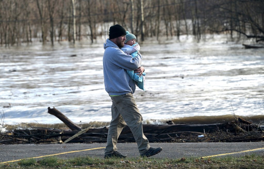
These are just some of the impacts being felt in central Maine on Tuesday, a day after a powerful wind and rain storm swept through New England. The deluge brought near hurricane-force winds to greater Augusta and dumped close to 6 inches of rain in parts of the state.
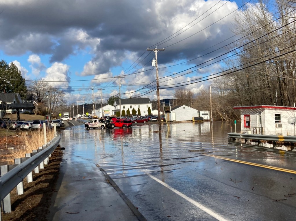
Flood warnings remain in effect through at least Friday along the Kennebec River, where high water has closed many roads in and around Skowhegan. In Kennebec County, the river breached its banks from Waterville to Gardiner.
Gov. Janet Mills declared a state of civil emergency in 14 of Maine’s 16 counties by the afternoon.
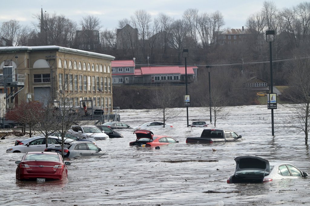
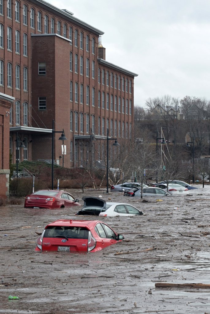
The Kennebec River floods the parking lot of the Hathaway Creative Center on Water Street in Waterville on Tuesday. Rich Abrahamson/Morning Sentinel
SUBMERGED CITIES
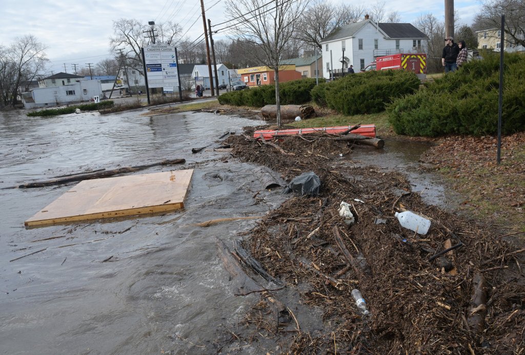
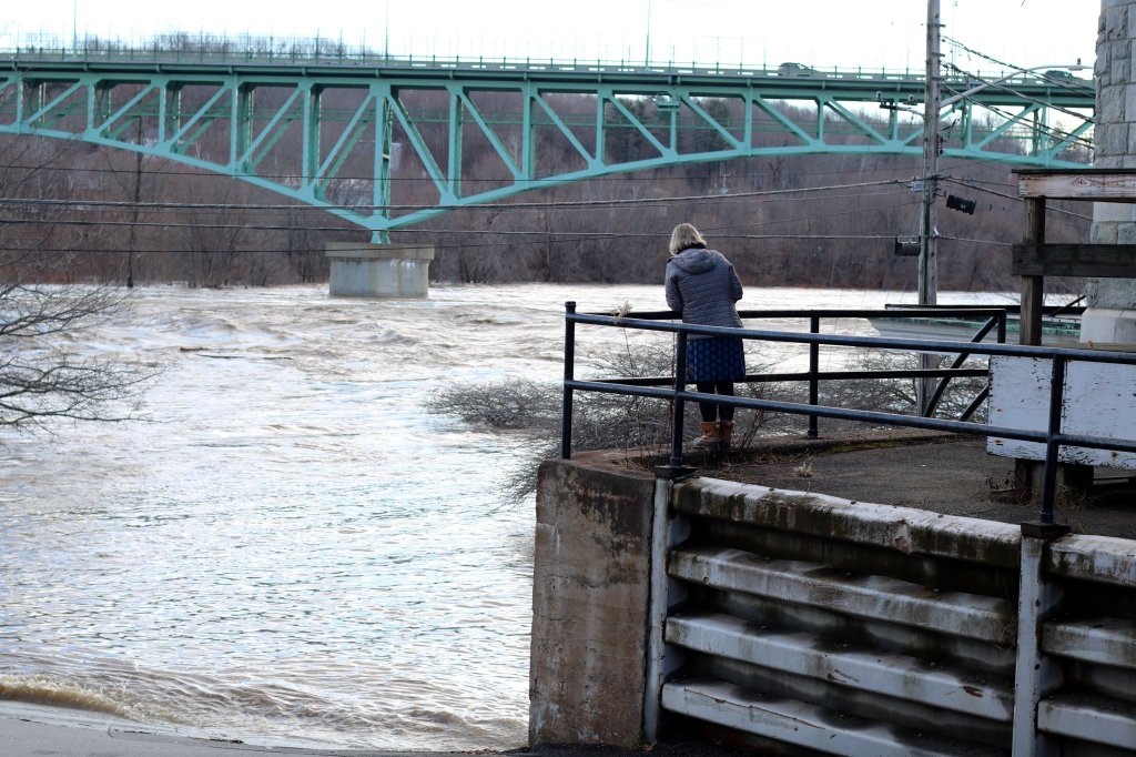
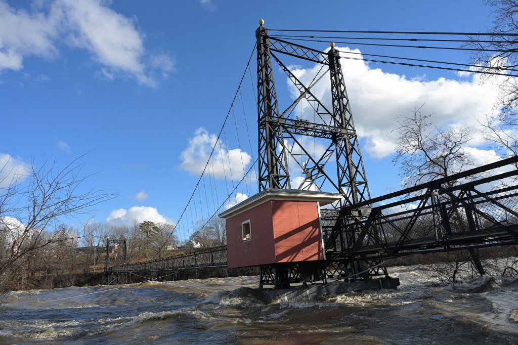
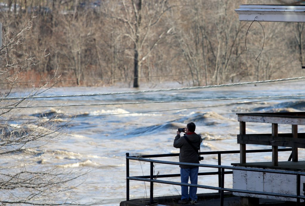
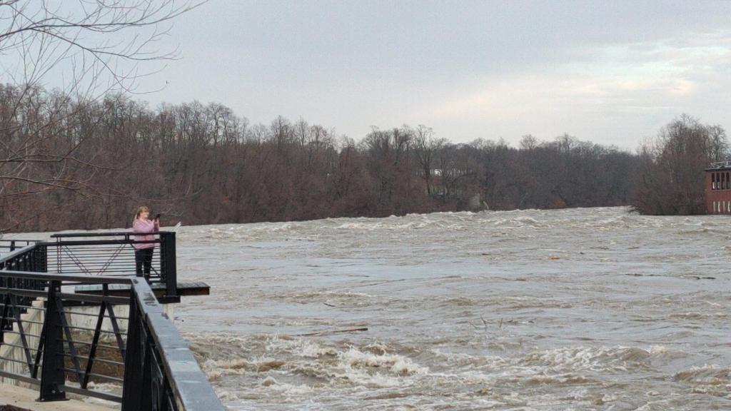
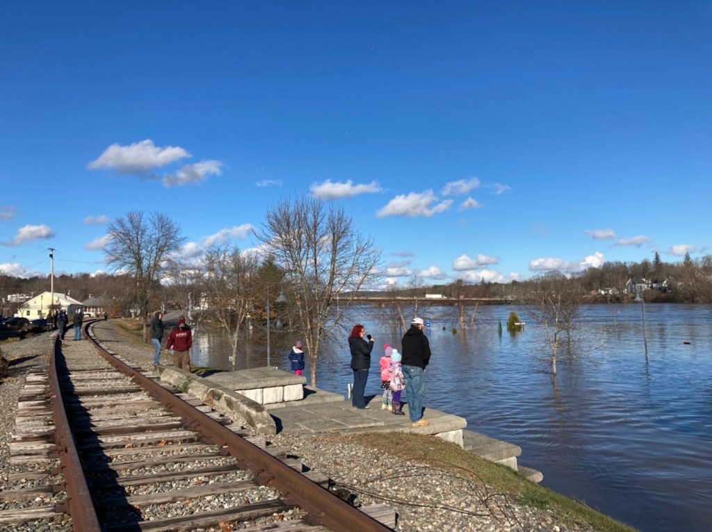
At the Riverwalk at Head of Falls in Waterville Tuesday morning, many onlookers came to take photos and video of the raging Kennebec River as its waves nearly reached the Two Cent walking bridge, which was closed. They watched as large logs, trees and debris washed downstream.
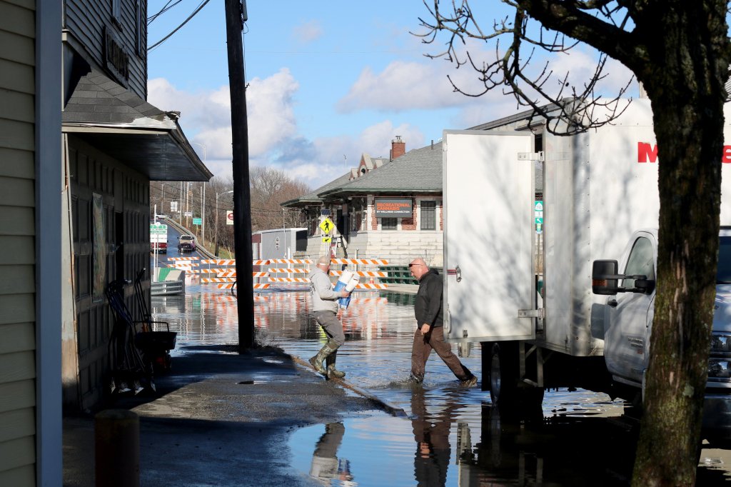
By 9:30 a.m., the parking lot outside the Hathaway Creative Center in Waterville had flooded, submerging several parked cars. Police halted traffic in the area as floodwaters continued rising.
Dylan and Olivia Koza were among the hundreds of residents evacuated from the building. The couple, who have lived at the Hathaway Center for three years, said they’ve seen minor flooding in the area before, but nothing that compared to Monday night’s storm.
“We just woke up this morning and our cars were flooded,” he said. “We had a smaller flood this spring, so we were aware that the Kennebec flooded, but it was more of a springtime thing we thought, so this was kind of a surprise.”
Dylan said residents of the apartment complex hadn’t received any warnings before the Kennebec breached its banks just before 9 a.m. Tuesday, though Waterville firefighters and police were quick to respond and evacuate residents.
The first floor of the Hathaway Center, which houses an antiques store and office space, was quickly inundated with water as the river continued to rise throughout Tuesday. The Hathaway’s residential apartments, which are concentrated on the fourth and fifth floors, were left largely unscathed by the flooding, Dylan said.

Dylan Koza carries work equipment Tuesday as he evacuates his apartment at the Hathaway Creative Center, seen in the background, on Water Street in Waterville. Koza and his significant other, Olivia Koza, lost both their cars when the Kennebec River flooded the parking lot of their building.
Elsewhere in the city, people scrambled to find locations with groceries and gas. Hannaford supermarket was bustling as one of the few city stores with generator-aided power, but workers were busy clearing out the freezer section after those products spoiled overnight.
Meanwhile, there were very few gas stations with power, and a line of cars stretched down West River Road as motorists waited a turn to get gas at a station there.
No Maine county was hit harder with power outages than Kennebec, where nearly 90% of customers served by Central Maine Power Co. were still in the dark as of Tuesday afternoon. The utility serves about 74,000 households there.
An issue with a transmission line was the primary cause of the outages in greater Waterville, CMP spokesperson Jonathan Breed said.
“We were able to reroute power for half of the customers that were impacted by the transmission issue,” he said around 2:30 p.m. “For the other half of customers, our crews are on site right now.”

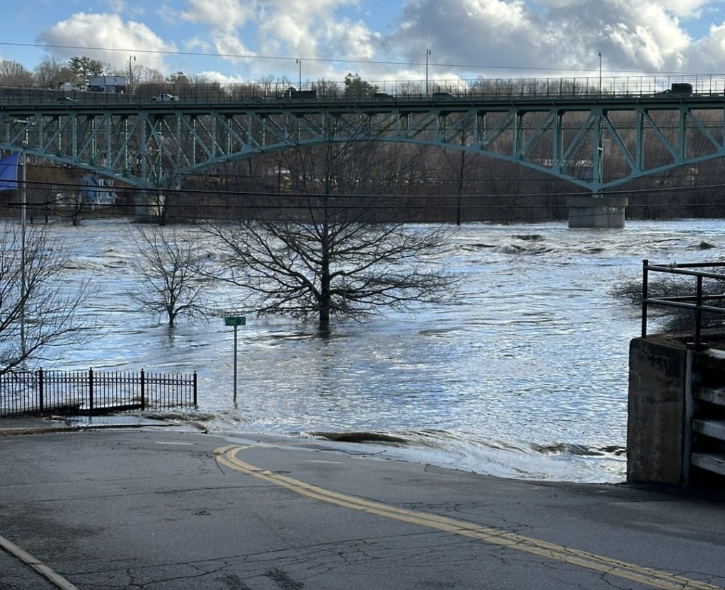
A swollen Kennebec River on Tuesday climbs up buildings on the back side of Water Street in Augusta. Waters rose to more than 30 feet and reached a flow of 144,000 cubic feet per second in parts of the river between Augusta and Waterville, according to the National Oceanic and Atmospheric Administration. The river is considered to be flooding once the depth reaches 17 feet and the water moves at 35,000 cubic feet per second.
In Augusta, broken branches and piles of wet leaves covered sidewalks, lawns and some streets. On State Street, the house frequented by resettled refugees and immigrants taking language classes had a part of its roof peeled off.
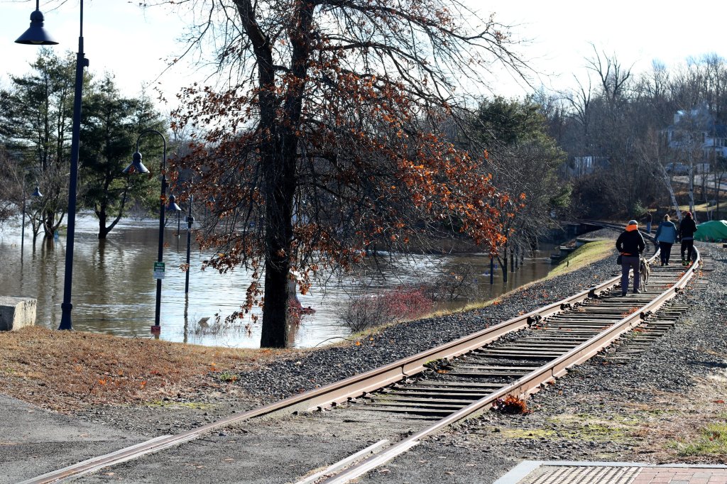
Downtown, a portion of Front Street and the entire Waterfront Park was submerged under the overflowing Kennebec River. Residents stood on the sidewalk taking pictures.
While that part of the city had power, it was cut off in the morning due to rising flood waters and a propane leak in one of the downtown buildings.
A member of the fire department who asked not to be identified said he had never seen water levels this high, and that the river is expected to rise further.
“All the basements on the right side of Water Street have flooded,” said Lt. John Robertson, Augusta Fire Department battalion chief.
HISTORIC FLOODING
By noon on Tuesday, the water in the Kennebec River was flowing at a rate that has not been matched since the 1980s — or in some cases, since the metric started being recorded in the 1930s.
Waters rose to more than 30 feet, designating “major flooding” from Waterville to Augusta. The National Oceanic and Atmospheric Administration classified the Kennebec’s flood stage as 17 feet and its flood standard at 35,000 cubic feet per second.
In Sidney, the flow was 144,000 cubic feet per second and rising on Tuesday, said Nick Statulis of the U.S. Geological Survey. The highest flow rate was 230,000 cubic feet per second during the historic flood of 1987.
In Bingham, where the period of record starts in the 1930s, the highest flow for the Kennebec until Tuesday was 65,000 cubic feet per second in 1984, but that’s been provisionally exceeded during the storm, Statulis said.
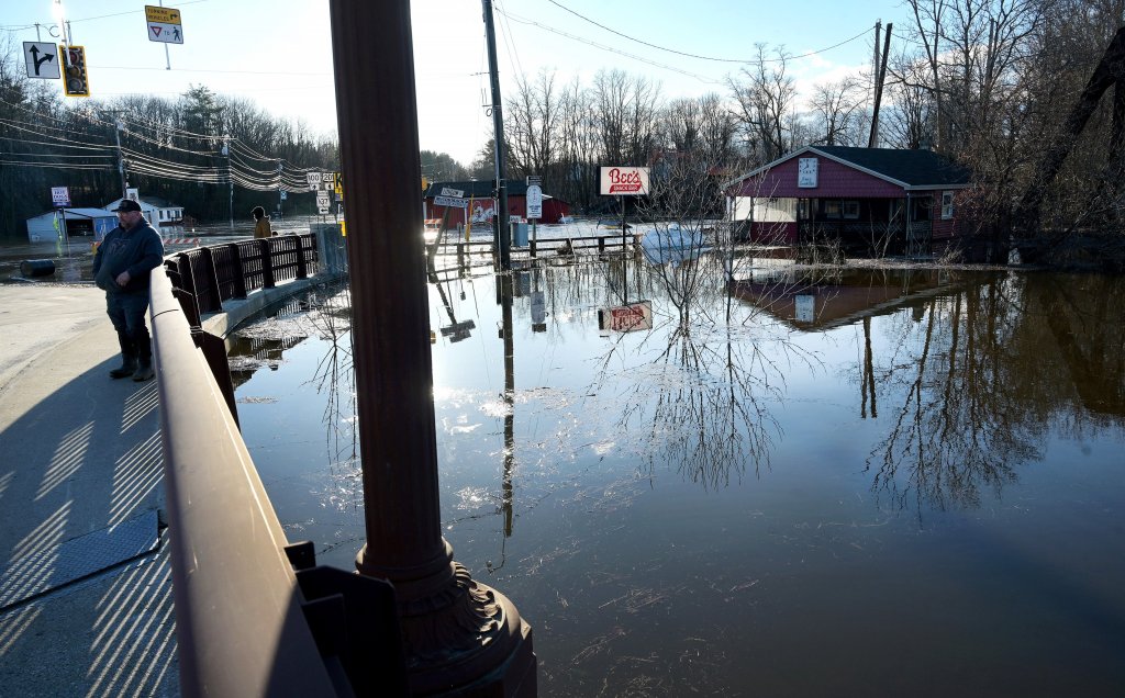
Hope Olivencia, owner of Goldfinch Creamery Cafe and Bakery in downtown Gardiner, walked out of her Main Street shop in the afternoon with leftover bagels in her hands.
She was ordered to leave her shop and to elevate the shop’s furniture off the ground.
People move items out of Harvey’s Hardware store in Gardiner on Tuesday as Maine Avenue floods in the aftermath of Monday’s storm. Anna Chadwick/Morning Sentinel
Though her cafe is on the other side of the street from the Kennebec River, she was told to prepare for the water to rise even more and potentially reach her storefront by Tuesday evening.
“I’ve only been in this location for 2 1/2 years, and the water has never reached this side in 40 years,” she said. “We lost power yesterday at 11 a.m. and already lost stuff in the freezer. My sign came crashing down, too.”
‘HEAVY RAINFALL EVENTS INCREASING IN NORTHEAST’
While the storm a week ago did knock down the snowpack in the mountains, it set the stage for the flooding from Monday’s storm.
Justin Arnott, a meteorologist with the National Weather Service in Gray, said streams and rivers were already swollen when the rain moved into Maine on Sunday night.
“Even if the river levels had been low, if you put 5 inches of rain in Maine into the rivers, you’re going to get some flooding,” Arnott said.
Waterville firefighters and others evacuate a disabled person Tuesday from an apartment at the Hathaway Creative Center on Water Street in Waterville. A firefighter says the individual was carried down stairs after the elevators were inoperable in a power outage when the Kennebec River flooded the parking lot of their building. Rich Abrahamson/Morning Sentinel
While many locations across the state received 2 or 3 inches, the heaviest rainfall in the forecast area for the Gray office was recorded in Kingfield, which received 6.06 inches.
In Kennebec County, the highest rainfall at 4.91 inches was recorded in Manchester.
The peak wind gust Monday in Augusta was 68 mph, just short of hurricane-force winds, according to Arnott.
The good news, said Statulis of the U.S. Geological Survey, is that the rain and snowmelt happened very quickly and then shut off. Because no more water is being added to the system, once flooding reaches its peak, it will drop quickly.
“It won’t be prolonged for days,” he said.
Before Monday’s storm, 2023 had already been marked with strong storms and flooding.
Derek Schroeter, one of the meteorologists at the National Weather Service in Gray, said following last week’s storm between May and August, the Gray office issued 20 flood warnings, 134 flood advisories, 78 flash flood warnings and 36 river flood warnings for the office’s forecast area, which includes New Hampshire.
“The amount of flash flood warnings and flood advisories are almost double the amount of the next highest year,” he said. That year was 1998.
The observations are that heavy rainfall events have been increasing in the Northeast, he said. In Maine, annual precipitation has increased by 5.8 inches since 1895, and a large portion of that increase is due to heavy rainfall events of 2 inches or more.
While windy, warm rainstorms are not unusual for December – in each of the last two years, strong storms bringing wind and rain blew through the state in the weeks before Christmas – the size and scope of Monday’s storm was.
“To see 5 inches of rain over a decent footprint for the area is pretty unusual,” Arnott said Tuesday. “And to see it back-to-back adds to the unusualness of it. What are the chances you’re going to put 3 inches down and a week later put another 4 or 5 inches down?”
RELIEF AND SHELTER
In Fairfield, police Tuesday morning requested voluntary evacuations on several streets in the town, according to department social media posts. Residents on Upper Main Street, the river side of Water Street, Bunker Avenue and Mill Island were being asked to leave ahead of the expected river crest around noon and seek shelter at the Victor Grange, police said. Authorities were making notifications of the orders door-to-door.
The grange is also open to anyone else in Fairfield seeking assistance, as is the Lawrence Public Library. Both locations have food and internet connectivity.
A woman looks out Tuesday at the flooding of Gardiner’s Maine Avenue in the aftermath of Monday’s storm. Anna Chadwick/Morning Sentinel
Across the region, many school districts remained closed Tuesday morning or announced late starts as power outages and road closures continued.
The governor closed all state government offices after initially announcing most would open at noon. Many municipal offices also announced delayed openings Tuesday.
Sean Goodwin, Kennebec County’s acting Emergency Management Agency director, said the Augusta Civic Center opened as a warming shelter, and in Waterville, 46 Front St. has opened as a warming center and charging station.
In Clinton, the Police Department was offering food, shelter and charging stations in the Selectmen’s Room at the town office located on Baker Street. The department was also offering free pizza until 4 p.m. In Pittsfield, the Warsaw Public Library was to serve as a charging station between 1-3 p.m. for those in need, the police department wrote on Facebook earlier Tuesday morning.
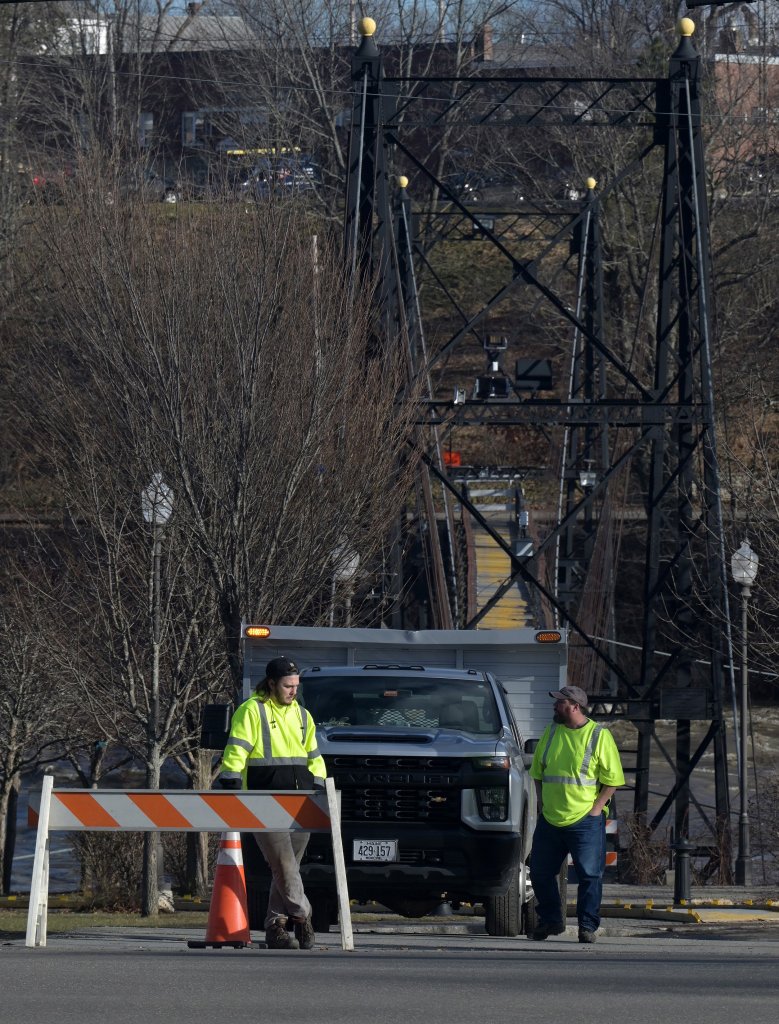
ROAD CLOSURES
Across the region, scores of roads remained blocked Tuesday as first responders and public works officials cleared fallen trees and debris.
State Route 27 was closed on Tuesday due to flooding of the Kennebec River in Randolph. Anna Chadwick/Morning Sentinel
There have been widespread reports of fallen trees and downed wires, and many roads were closed Tuesday because of flooding or washouts. State Route 27 from New Vineyard to the Canadian border was closed due to wires down and extreme flooding and washouts.
In the Augusta area, state Route 27 in Randolph was closed between Route 226 and the town line because of flooding at Togus Stream, Maine Avenue in Hallowell was closed due to flooding and Waugan Road was closed in Monmouth due to high water.
Paul Ferland, police chief in Winthrop, said some roads in town have been undermined by flooding, including Pleasant Street, Turkey Lane and Case Road. He said Case Road is terrible and advised motorists to stay off those roads until repairs are made.
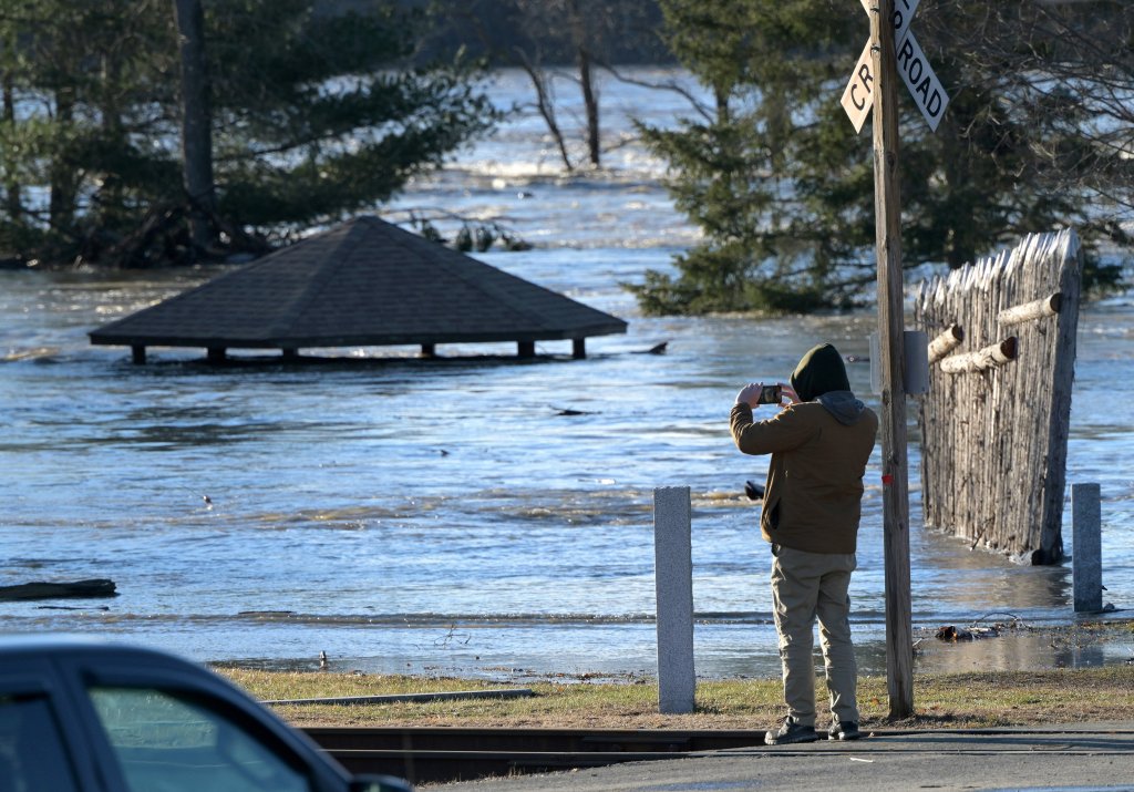
Floodwaters submerge Mill Park in Augusta on Tuesday. Courtesy of Dave Dostie
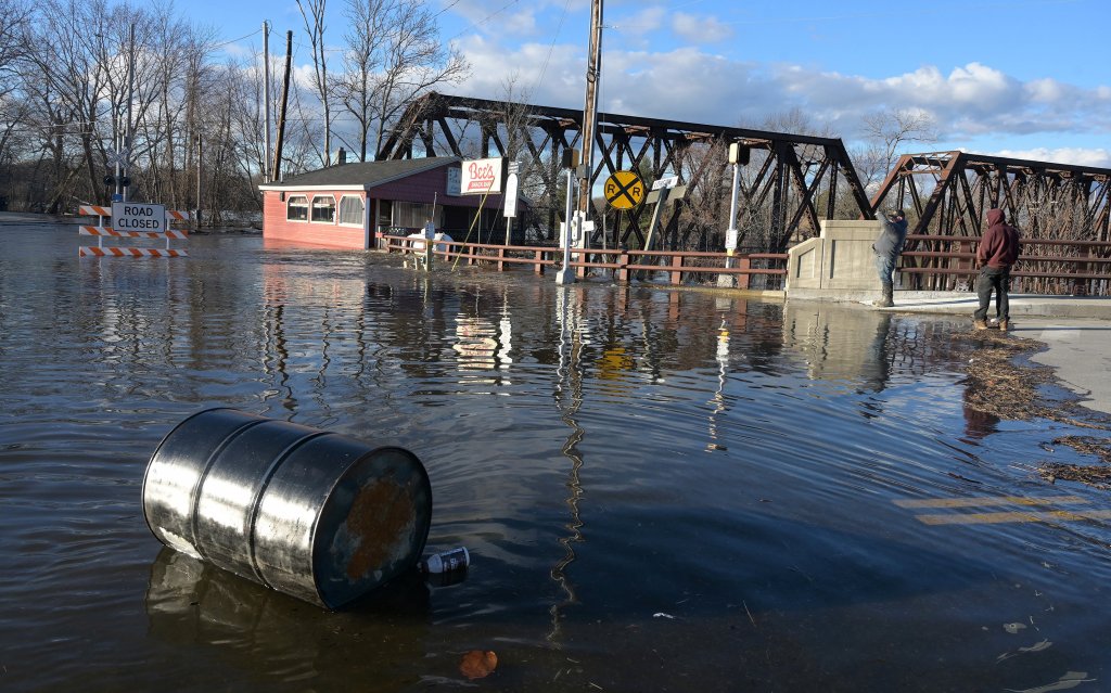
With the water projected to keep rising, Augusta police closed the Calumet Bridge — the lowest bridge that crosses the Kennebec River in Augusta — and Water Street in the city’s downtown on Tuesday afternoon. Interim police Chief Kevin Lully said the river could remain above flood stage for the next few days due to the rain and snow melt.
The city also closed Bridge Street, Northern Avenue, the Front Street parking lot, Colonial Theater and Eagles Club parking lots, Mill Park, and all other city-owned or maintained property along the Kennebec River shoreline. The closures are expected to continue until water levels recede. Vehicles parked in those areas may be towed at the owners expense, police warned.
In Skowhegan, high flows on the Kennebec River prompted police to close the Margaret Chase Smith bridges, which carry traffic over the downtown island, at 8 a.m.
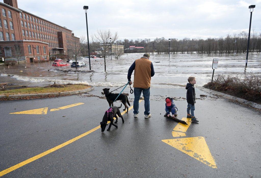
Phil Keegan of Waterville holds dogs, Maggie and Gunner, while watching as the Kennebec River floods the parking lot of the Hathaway Creative Center. With Keegan are family friends, Ollie Canard, 5, right, and his brother Theo Canard, 2, from Waterville. Rich Abrahamson/Morning Sentinel
At around 12:30 p.m., dozens of onlookers watched from shore and a pedestrian bridge over the gorge as the river rushed just underneath the two bridges. Several emergency vehicles were still able to drive over. Water breached the parking lot of the former Solon Manufacturing mill on the island, which is currently undergoing renovations. It appeared the flood waters displaced multiple large storage containers as well as other construction equipment.
At one point Monday night, Route 201 in Bingham was closed because of flooding and on Tuesday the Madison-Anson Bridge was closed.
911 SYSTEM IMPACTED
The Winthrop emergency communications center lost its phone lines due to the storm, forcing officials to rely on cell phones to receive 911 calls transferred by state Department of Public Safety and Androscoggin County dispatchers in order to send police, fire and rescue to emergencies.
People calling 911 with an emergency still had that call answered throughout the storm, according to Chief Ferland. All 911 calls placed in Winthrop and Monmouth, which relies on Winthrop’s communications center for police and fire dispatching, go to either state or Androscoggin County dispatch centers, both normally and during the storm. However due to the storm, Winthrop’s communications center lost its main communications line, and was thus unable to take incoming calls, including from either of those other dispatch centers which initially take 911 calls from Winthrop and Monmouth. Instead, dispatchers in the state and county communications centers reached Winthrop officials by their cell phones, and continued to reach them that way Tuesday while repairs to bring the phone system back up and running were underway.
The town center of Hallowell is unreachable Tuesday afternoon, with both sides of Route 201 closed and cars coming from Gardiner being directed to turn around. Emily Duggan/Kennebec Journal
Ferland said anyone in Winthrop or Monmouth with an emergency should still call 911, and the call will be taken, as usual, by either of the two centers which normally take those 911 calls. Those dispatchers would then reach public safety officials in those towns so they could dispatch public safety workers to respond.
Ferland said officials are working with a phone service provider to setup phone numbers which people with routine, nonemergency needs can use to reach the police department. He said he hoped the normal phone lines would be restored by the end of the day Tuesday.
Monday afternoon, a post on the town’s Facebook page stated the dispatch center’s phone lines were down and in order to file a “911 report” people should call a cell phone number it listed. Ferland said that post was made in error as the result of a misunderstanding.
The dispatch center in Winthrop can be reached, for nonemergency business at 931-9124 until the phone line problems are fixed.
Morning Sentinel staff writers Dylan Tusinski, Jake Freudberg and Sukanya Mitra; Kennebec Journal staff writers Emily Duggan, Keith Edwards and Aryan Rai; and Managing Editor Scott Monroe contributed to this report.
Copy the Story LinkSend questions/comments to the editors.

Success. Please wait for the page to reload. If the page does not reload within 5 seconds, please refresh the page.
Enter your email and password to access comments.
Hi, to comment on stories you must . This profile is in addition to your subscription and website login.
Already have a commenting profile? .
Invalid username/password.
Please check your email to confirm and complete your registration.
Only subscribers are eligible to post comments. Please subscribe or login first for digital access. Here’s why.
Use the form below to reset your password. When you've submitted your account email, we will send an email with a reset code.