


AUGUSTA — More than two-thirds of Central Maine Power Co. customers in Kennebec County remained without power Wednesday, two days after a powerful storm left historic flooding and widespread outages in its wake.
Gov. Janet Mills, who declared a state of civil emergency Tuesday for the affected counties — every county except York and Cumberland — spoke at a news conference midday after viewing storm impacts and a briefing from state emergency management officials. Before the news conference, she toured areas of Water Street in downtown Augusta that were impacted by flooding from the Kennebec River.
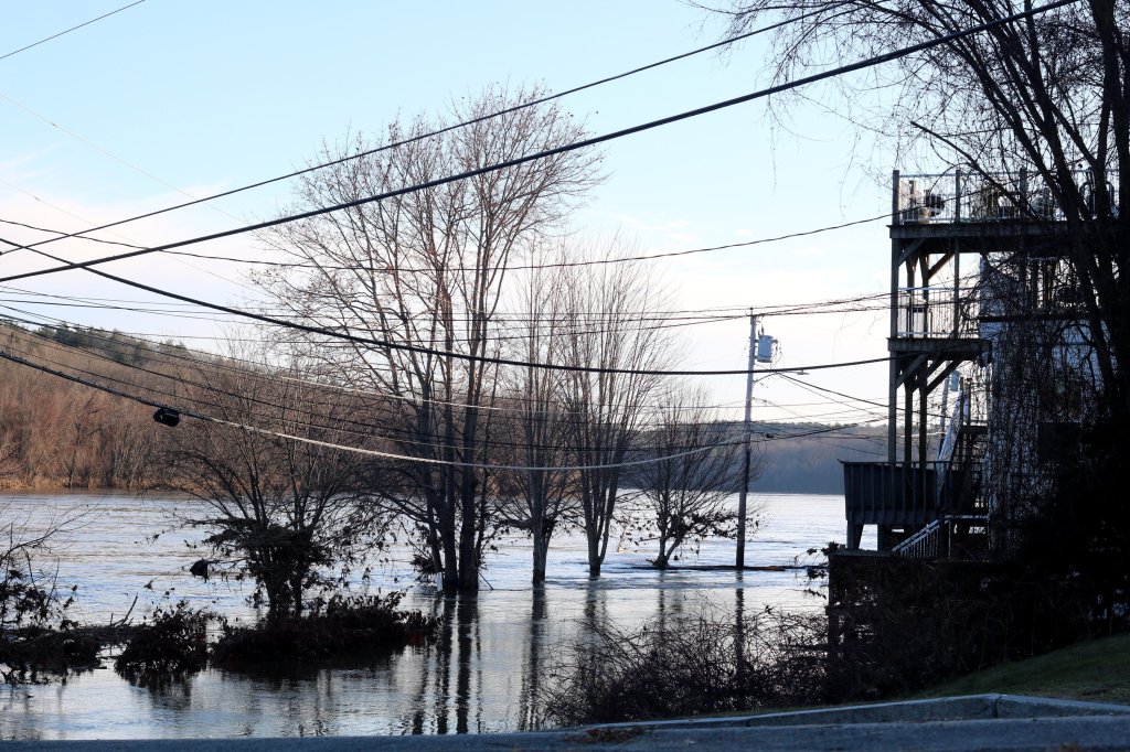
The flooding is central Maine’s worst since the devastating flood of 1987, according to the National Weather Service in Gray and National Oceanic and Atmospheric Association.
Gov. Janet Mills on Wednesday morning tours areas of Water Street in downtown Augusta that were impacted by flooding in the wake of Monday’s powerful storm that wrought damages and power outages across Maine. Mills declared a civil emergency on Tuesday. Anna Chadwick/Morning Sentinel
Meanwhile, the weather service issued a forecast that shows temperatures across the region are dropping to more seasonal levels, bringing the possibility that any standing water could freeze.
“If any mitigation can be taken to drain water from areas safely, now will be the time to do it,” the weather service posted on social media around 10:30 a.m.
Many schools across the central Maine region remained closed Wednesday, although at least one district — Oakland-based Regional School Unit 18 — made arrangements to open schools after a two-hour delay to ensure students could be warm and get a meal.
Other schools were making arrangements to hand out bagged lunches Wednesday. In Fayette, the Fayette Central School was offering free bagged lunches to any child in town. At Sylvio Gilbert Elementary School in Augusta, staff was expected to be on hand to pass out food bags and other supplies for its students.
But with no power and roads that remained closed because of flooding or downed trees and powerlines, most schools planned to remain closed, with the exception of Richmond schools.
Patricia Hopkins, superintendent of the Gardiner-area school district, said most of the district’s staff was without power and unable to get to their schools.
Hopkins said she hopes schools will be able to open Thursday before the holiday break, but many superintendents are monitoring conditions before making that decision.
‘MORE THAN ANYBODY ANTICIPATED’
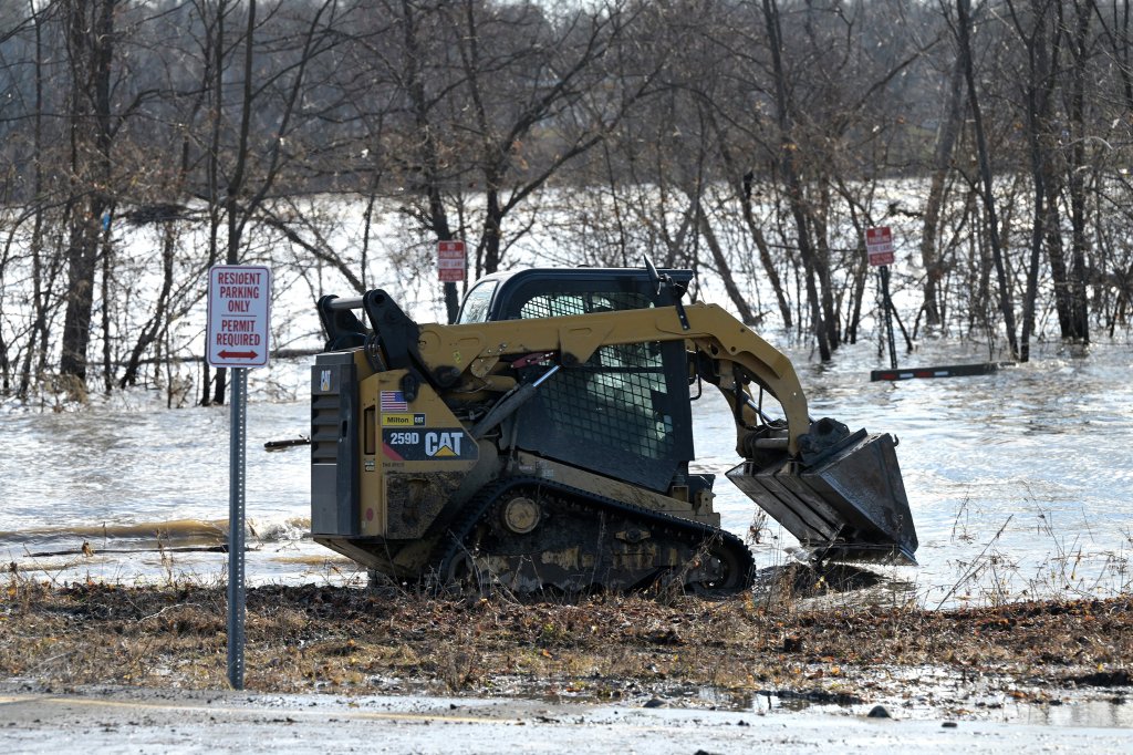
While flooding along the Kennebec River reached its peak overnight, the river remained in flood stage, and communities along the river continued to impose closures in some areas. In others, particularly around Skowhegan, roads have been reopened to traffic.
In Augusta, the city announced Wednesday morning that in addition to portions of Water and Front streets, closures would also be imposed on lower Northern Avenue near Bond Street, and on Bond Street, until water levels recede. Officials were also monitoring Mt. Vernon Avenue and the Calumet Bridge.
Gov. Janet Mills on Wednesday morning tours areas of Water Street in downtown Augusta that were impacted by flooding in the wake of Monday’s powerful storm that wrought damages and power outages across Maine. On Tuesday, Mills declared a civil emergency. Anna Chadwick/Morning Sentinel
By Wednesday afternoon, all roads in Augusta were open except for Front Street, which sits at the edge of the river in the city’s downtown.
“I would say that besides the tree damage, I think we survived very well,” said Lesley Jones, director of Augusta’s Public Works Department. “I have not heard any of the supervisors talk about erosion or culverts washed out. We have been focused on tree removal, but that doesn’t mean we won’t find some.”
Jones said local drainage systems were not designed to handle the intense storms that have been occurring.
“The storms have changed so much in the 35 years I’ve been doing this. We’re getting these intense snow bursts, these intense downpours and drainage systems and the culverts are just not set up to handle it,” she said.
All rural roads in the city are clear, and crews will be working in neighborhoods for the rest of the week, she said.
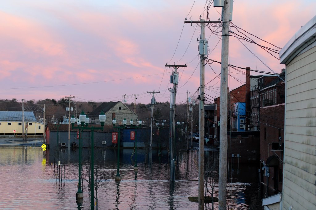
Water Street in Hallowell remained closed Wednesday morning as flood waters subsided. City Manager Gary Lamb said only the section of Water Street by the boat launch at the south end of downtown is closed.
On Tuesday, “an army” of people including Lamb, members of Hallowell City Council and others helped business owners along Water Street shift their inventory out of danger.
“This was about 4 or 5 feet above the May storm,” Lamb said.
Lamb said some residents were evacuated from the south end of downtown from a propane leak after rising floodwaters covered the tank.
In Gardiner, where the Arcade lot along Cobbosseecontee Stream remained underwater, the Maine Department of Transportation has closed the Maine Avenue Bridge. The bridge and the footbridge next to it cross the stream not far from where it enters the Kennebec River.
A woman looks out Tuesday at the flooding of Gardiner’s Maine Avenue in the aftermath of Monday’s storm. Anna Chadwick/Morning Sentinel
The bridge is also not far from where floodwaters swept across the Hannaford’s parking lot and into the store.
City Manager Andrew Carlton said aside from the downtown flooding, Gardiner has fared well. He and city department heads met early Monday to map out their response.
“The staff has really done a great job,” he said.
There have been some minor issues with the wastewater treatment plant, and the Fire Department stationed a truck across the river in Pittston because of road closures on the east side of the Kennebec.
“Doing cleanup has been a priority for us today,” he said. “Brunswick Avenue still has a powerline across it at the top of Brunswick Hill, so we have a detour going around it.”
City offices were closed Wednesday because the generator at City Hall died overnight and a replacement was finally secured midday.
“This turned out to be far more than anybody anticipated, that’s for sure,” Carlton said.
‘EXTREMELY DANGEROUS’
When floodwaters crested at around 5:15 p.m. on Tuesday, the Kennebec River swelled to at least 32.32 feet just south of Waterville, according to NOAA data. It was the second highest crest the water gauge in North Sidney has recorded since data began being collected in the 1970s, NWS meteorologist Ryan Palmer said, second only to the flood of 1987, which crested at 39.31 feet.
“We can say for sure at this point that this was the second highest flood in North Sidney,” Palmer said Wednesday morning. “This was an extremely dangerous and very high flood.”
Palmer said that the a combination of factors, including climate change and El Niño, contributed to the storm’s formation and the intense flooding.
With NOAA’s Climate Prediction Center expecting a warmer than average winter ahead, Palmer said Maine will likely see storms of similar intensity in the coming months.
A culmination of factors made this storm so ferocious, Palmer said, including warm ocean temperatures and hot air in the atmosphere, both of which are symptoms of climate change. El Niño has also been strong this year, he said, which has increased precipitation all across the East Coast.
El Niño is a sporadic climate pattern that occurs every few years in the Pacific Ocean characterized by a warming of the ocean surface, which can have significant effects on weather patterns around the world.
Thatcher Larrabee, an employee at the U.S. Geological Survey, examines Kennebec River water levels Wednesday in Augusta. Anna Chadwick/Morning Sentinel
“What made this storm so dangerous was that it had a really strong, warm, moist flow coming onshore from the Gulf of Maine,” Palmer said. “With warmer temperatures you’ll generally have more precipitation. All that warm, moist air, went straight to the mountains and was pushed up to the mountains, which allowed a lot more moisture to condensate in the mountains, and that turn, that translated into significantly more precipitation.”
Combined with soil saturated from Maine’s wettest year ever and a higher-than-usual snowpack still on the ground in the mountains, Palmer said, it was an unfortunately perfect storm.
“We had the wettest summer on record,” Palmer said. “There definitely has been some research done recently, and what that research suggests is that events like this could become more frequent with climate change.” Heavy precipitation caused by warm ocean temperatures, combined with snow on the ground inland, pumped tons of water into central Maine’s rivers.
“In El Niños, we tend to be wetter,” he said. “ What made the storm so bad was that we had a really strong, warm, moist flow coming onshore from the Gulf of Maine, so we had really warm temperatures ahead. And with warmer temperatures, generally have more precipitation, because you can contain more moisture in the atmosphere … Loss of most of the snowpack, plus 6 inches of rain within less than 24 hours and you’re displacing a lot of water into the rivers.
OUTAGES PERSIST
While Monday’s storm arrived with unseasonably warm record-breaking temperatures, colder weather moved in overnight Tuesday, prompting cities and towns to open warming shelters and places to charge devices on Wednesday as more than 74,000 started Wednesday without power.
Across Kennebec County, outages remained widespread, with the highest percentage of outages Wednesday morning in Belgrade, China, Farmingdale, Manchester, Monmouth, Oakland, Sidney, Vassalboro, Winslow and Winthrop.
Arcade Street in Gardiner is seen Wednesday after a powerful storm caused major flooding of the Kennebec River. Anna Chadwick/Morning Sentinel
The number of outages across central Maine gradually dropped during the day, as Avangrid, Central Maine Power’s parent company, brought in more resources to pitch in with storm recovery.
While many businesses were closed Tuesday, including grocery stores, many announced open hours for Wednesday as conditions, including availability of power and internet, permitted.
Meanwhile, people across central Maine scrambled to find gas stations that were open and had power, so they could continue to fuel their generators, relying on tips shared on Facebook.
In Winthrop, where during the worst of the storm the emergency communications center lost its phone lines, the telephone system was restored around 8:30 p.m. Tuesday, according to police Chief Paul Ferland. While phone lines were out of service, officials relied on cell phones to receive emergency communications for people in Winthrop and Monmouth calling 911 for emergencies.
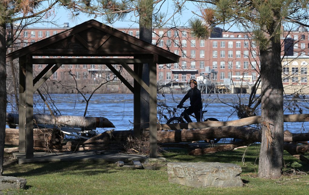
Onlookers walk through Old Fort Western admiring the Kennebec River on Wednesday after the storm in Augusta. Anna Chadwick/Morning Sentinel
Ferland said the phone system is now back to normal and anyone with an emergency should continue to call 911 while anyone in need of nonemergency assistance can resume using the department’s regular phone number, 377-7226.
Ferland said officials plan to determine why the phone lines failed during the storm.
COMMUNITIES RECOVER
In Skowhegan, officials reopened the Margaret Chase Smith bridges, which carry traffic on and off the downtown island, Wednesday morning after they were cleared by a Maine Department of Transportation inspection. As of about 11 a.m., all roads in the town are back open, according to David Bucknam, Skowhegan’s police chief and interim town manager.
“Compared to the rest of Maine, we’re doing pretty amazing,” Bucknam said.
But the ongoing Spinning Mill renovation project on the island was severely damaged by flooding, according to Dash Davidson, one of its owners. Davidson put early damage estimates in the millions.
Otherwise, a few houses had their basements flooded, Bucknam said, but overall, most homes and businesses were not affected by the flooding. Bucknam also suspects the Kennebec River dam in the town will need some work, given the large debris that was forced downstream as the river rose. In a positive sign amid difficult recovery efforts across the state, Bucknam noted an American flag hung on the dam managed to hang on, even as it was submerged by historic flows for hours.
Zack Pike, owner of Pike Project Development, walks Wednesday toward 250-gallon hot water heaters that were ruined when 5 feet of water swept into the basement of the former Maine Spinning Mill building during a flood of the Kennebec River. The building at 7 Island Ave. is part of a renovation project on the edge of downtown Skowhegan. Rich Abrahamson/Morning Sentinel
In Fairfield, most residents living on Bunker Avenue and Mill Island were evacuated Tuesday following an additional 3 feet of water near the island. The Police Department urged residents to seek shelter at the Victor Grange located on 144 Oakland Road.
“Initially it was just a voluntary notice because of the concern of the rising water and how quickly it was rising,” Officer Casey Dugas said Wednesday. “But it went pretty smoothly.”
Around 30 people on Water Street were advised by police officials to evacuate and seek shelter someplace elsewhere, along with several people housed on Upper Maine Street, and the entire mobile home park, Dugas said.
“Everyone is OK to go back to their residences now since we can’t prevent them from not going back to their homes,” he said.
Staff writers Dylan Tusinski, Sukanya Mitra, Jake Freudberg, Emily Duggan, Keith Edwards and Aryan Rai contributed reporting.
Copy the Story LinkSend questions/comments to the editors.

Success. Please wait for the page to reload. If the page does not reload within 5 seconds, please refresh the page.
Enter your email and password to access comments.
Hi, to comment on stories you must . This profile is in addition to your subscription and website login.
Already have a commenting profile? .
Invalid username/password.
Please check your email to confirm and complete your registration.
Only subscribers are eligible to post comments. Please subscribe or login first for digital access. Here’s why.
Use the form below to reset your password. When you've submitted your account email, we will send an email with a reset code.